| Rongme Ngatra | |
|---|---|
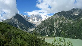
 Rongme Ngatra above Yihun Lhatso Rongme Ngatra above Yihun Lhatso | |
| Highest point | |
| Elevation | 6,168 m (20,236 ft) |
| Prominence | 1,703 m (5,587 ft) |
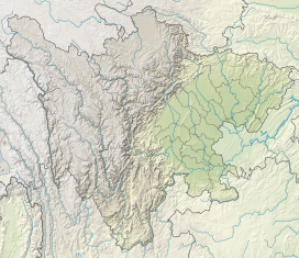
| Coordinates | 31°47′09″N 99°04′22″E / 31.78583°N 99.07278°E / 31.78583; 99.07278 |
| Geography | |
  | |
| Parent range | Chola Mountains |
| Climbing | |
| First ascent | 1988 |
Rongme Ngatra is the highest peak of the Chola Mountains in the Kham region of western Sichuan, China. The peak's name in Mandarin Chinese is Que Er Shan (Chinese: 雀儿山; pinyin: Què'ér Shān) also the same name as the entire range, which has led to some translations of the mountain peak to Chola Mountain. At 6,168 metres (20,236 ft), the mountain is the highest peak in the Chola Mountains, as well as the second highest in the greater Shaluli Mountains after Ge'nyen. The mountain peak is flanked by glaciers to the north and east. The north glacier terminates at 4,100 metres (13,500 ft) above sea level, just above the nearby lake Yihun Lhatso. Rongme Ngatra can be accessed from the town of Manigango in Dege County, Garze Prefecture.
References
- "Chola Shan I, China". peakbagger.com. Retrieved 6 July 2021.
- Atlas of China. Beijing, China: SinoMaps Press. 2006. ISBN 9787503141782.
- China's Southwest. Lonely Planet. 2007. ISBN 9781741041859.