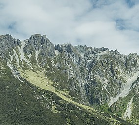
| Ruataniwha Conservation Park | |
|---|---|
 Ruataniwha Conservation Park Ruataniwha Conservation Park | |
 | |
| Location | New Zealand |
| Nearest town | Twizel |
| Coordinates | 44°00′00″S 169°58′57″E / 43.9999981°S 169.9824904°E / -43.9999981; 169.9824904 |
| Area | 37,145 hectares (91,790 acres) |
| Established | 2006 |
| Governing body | Department of Conservation |
Ruataniwha Conservation Park is a protected area near Twizel, in the Mackenzie District and Canterbury Region of New Zealand's South Island.
The park is managed by the New Zealand Department of Conservation.
Geography
The park covers 37,145 hectares (91,790 acres), including Dobson Valley, Hopkins Valley, Huxley Valley, Temple Valley and Maitland Valley and the Ben Ohau Range.
History
The park was established in 2006.
References
- ^ "DOC Profile". doc.govt.nz. Department of Conservation.
- ^ Nathan, Simon. "National and conservation parks". Te Ara - the Encyclopedia of New Zealand. Ministry for Culture and Heritage.
| Mackenzie District, New Zealand | |||||
|---|---|---|---|---|---|
| Seat: Fairlie | |||||
| Populated places |
| ||||
| Geographic features | |||||
| Facilities and attractions | |||||
| Government | |||||
This Canterbury Region-related geography article is a stub. You can help Misplaced Pages by expanding it. |