| Ruteng | |
|---|---|
  | |
| Coordinates: 8°36′46″S 120°27′47″E / 8.61265°S 120.463°E / -8.61265; 120.463 | |
| Country | Indonesia |
| Region | Lesser Sunda Islands |
| Province | East Nusa Tenggara |
| Regency | Manggarai |
| Area | |
| • Total | 38.81 km (14.98 sq mi) |
| Elevation | 1,188 m (3,898 ft) |
| Population | |
| • Total | 65,694 |
| • Density | 1,700/km (4,400/sq mi) |
| Time zone | UTC+8 (WITA) |
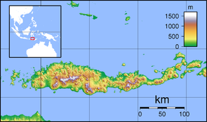
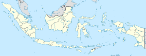
Ruteng is a town in the highlands towards the western end of Flores Island, Indonesia. It is the administrative capital of Manggarai Regency, serviced by the Frans Sales Lega Airport or Ruteng Airport. The population is predominantly Roman Catholic, but still preserve the ancient Manggarai custom of caci (whip fighting), which is usually practiced at weddings, and serves as a tourist attraction.
The Liang Bua archeological site is nearby, around 10 km to the north of Ruteng.
Administration
The town of Ruteng is equivalent to the administrative district (kecamatan) of Langke Rembong, which covers an area of 38.81 km, and is composed of twenty urban villages (kelurahan); note that is does not include the administrative district named Ruteng, which is actually a mainly rural district (with one kelurahan and eighteen rural villages (desa)), which lies to the west of Langke Rembong District and thus of the town.
The areas and populations (as at mid 2023) of the component kelurahan of Langke Rembong District are tabulated below, together with their postcodes.
| Kode Wilayah |
Name of kelurahan or desa |
Area in km |
Pop'n Estimate mid 2023 |
Post code |
|---|---|---|---|---|
| 53.10.12.1001 | Golo Dukal | 2.02 | 3,729 | 86515 |
| 53.10.12.1002 | Wali | 1.88 | 4,918 | 86514 |
| 53.10.12.1003 | Karot | 3.57 | 4,581 | 86512 |
| 53.10.12.1004 | Pitak | 0.68 | 4,787 | 86513 |
| 53.10.12.1005 | Lawir | 0.28 | 1,650 | 86516 |
| 53.10.12.1006 | Pau | 2.21 | 8,210 | 86516 |
| 53.10.12.1007 | Waso | 3.67 | 3,727 | 86517 |
| 53.10.12.1008 | Watu | 4.65 | 5,345 | 86511 |
| 53.10.12.1009 | Mbaumuku | 0.40 | 1,932 | 86511 |
| 53.10.12.1010 | Tenda | 1.78 | 3,501 | 86518 |
| 53.10.12.1011 | Carep | 3.67 | 3,036 | 86519 |
| 53.10.12.1012 | Bangka Nekang | 0.54 | 2,432 | 86511 |
| 53.10.12.1013 | Satar Tacik | 1.42 | 5,006 | 86518 |
| 53.10.12.1014 | Poco Mal | 1.29 | 1,757 | 86518 |
| 53.10.12.1015 | Compang Carep | 0.54 | 1,004 | 86519 |
| 53.10.12.1016 | Laci Carep | 0.61 | 970 | 86519 |
| 53.10.12.1017 | Tadong | 2.00 | 1,697 | 86512 |
| 53.10.12.1018 | Rowang | 0.74 | 1,033 | 86517 |
| 53.10.12.1019 | Bangka Leda | 5.49 | 2,882 | 86515 |
| 53.10.12.1020 | Compang Tuke | 1.37 | 2,374 | 86514 |
| 53.10.12 | Totals | 38.81 | 65,694 |
Climate
Ruteng has a subtropical highland climate (Cfb) that borders the tropical rainforest climate (Af) with moderate rainfall from June to August and heavy to very heavy rainfall in the remaining months.
| Climate data for Ruteng | |||||||||||||
|---|---|---|---|---|---|---|---|---|---|---|---|---|---|
| Month | Jan | Feb | Mar | Apr | May | Jun | Jul | Aug | Sep | Oct | Nov | Dec | Year |
| Mean daily maximum °C (°F) | 24.9 (76.8) |
24.6 (76.3) |
25.1 (77.2) |
25.2 (77.4) |
24.7 (76.5) |
24.0 (75.2) |
23.9 (75.0) |
24.5 (76.1) |
25.4 (77.7) |
26.3 (79.3) |
26.0 (78.8) |
25.3 (77.5) |
25.0 (77.0) |
| Daily mean °C (°F) | 20.2 (68.4) |
20.0 (68.0) |
20.3 (68.5) |
20.1 (68.2) |
19.6 (67.3) |
18.8 (65.8) |
18.3 (64.9) |
18.5 (65.3) |
19.4 (66.9) |
20.5 (68.9) |
20.9 (69.6) |
20.5 (68.9) |
19.8 (67.6) |
| Mean daily minimum °C (°F) | 15.5 (59.9) |
15.4 (59.7) |
15.5 (59.9) |
15.1 (59.2) |
14.6 (58.3) |
13.6 (56.5) |
12.7 (54.9) |
12.5 (54.5) |
13.4 (56.1) |
14.7 (58.5) |
15.8 (60.4) |
15.7 (60.3) |
14.5 (58.2) |
| Average precipitation mm (inches) | 541 (21.3) |
482 (19.0) |
495 (19.5) |
306 (12.0) |
213 (8.4) |
98 (3.9) |
71 (2.8) |
80 (3.1) |
142 (5.6) |
284 (11.2) |
394 (15.5) |
458 (18.0) |
3,564 (140.3) |
| Source: Climate-Data.org | |||||||||||||
References
- ^ Badan Pusat Statistik, Jakarta, 26 September 2024, Kecamatan Langke Rembong Dalam Angka 2024 (Katalog-BPS 1102001.53103110)
- "Climate: Ruteng". Climate-Data.org. Retrieved July 9, 2020.
This East Nusa Tenggara location article is a stub. You can help Misplaced Pages by expanding it. |