| This article needs additional citations for verification. Please help improve this article by adding citations to reliable sources. Unsourced material may be challenged and removed. Find sources: "São José dos Ausentes" – news · newspapers · books · scholar · JSTOR (October 2014) (Learn how and when to remove this message) |
| São José dos Ausentes Ausentino | |
|---|---|
 | |
 Flag Flag Seal Seal | |
| Nickname: Ausentes(Absents in english) | |
 | |
| Coordinates: 28°45′00″S 50°03′50″W / 28.75000°S 50.06389°W / -28.75000; -50.06389 | |
| Country | Brazil |
| Region | South |
| State | State of Rio Grande do Sul |
| Founded | March 20, 1992 |
| Government | |
| • Mayor | Ernesto Valim Boeira |
| Area | |
| • Total | 1,176.685 km (454.321 sq mi) |
| Elevation | 1,200 m (3,900 ft) |
| Population | |
| • Total | 3,543 |
| • Density | 2.796/km (7.24/sq mi) |
| Time zone | UTC−3 (BRT) |
| Website | São José dos Ausentes City Hall |
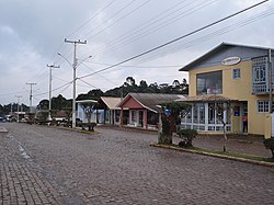
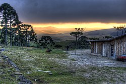
São José dos Ausentes is a municipality with an average altitude of 1200 meters, in the state of Rio Grande do Sul, Brazil. Its population was approximately 3,543 in 2020. It has an area of approximately 1176 km². Pico do Monte Negro is located in São José dos Ausentes, with its peak 1403 meters above sea level. It is the highest point in Rio Grande do Sul State. The town is 220 km far from state's capital, Porto Alegre.


Geography
Climate
São José dos Ausentes features an Oceanic climate (type Cfb), It features an annual uniform precipitation. The Annual average temperature is 13 °C The city is one of the coldest in Brazil and snow precipitation is not uncommon.
| Climate data for São José dos Ausentes | |||||||||||||
|---|---|---|---|---|---|---|---|---|---|---|---|---|---|
| Month | Jan | Feb | Mar | Apr | May | Jun | Jul | Aug | Sep | Oct | Nov | Dec | Year |
| Mean daily maximum °C (°F) | 23.8 (74.8) |
22.8 (73.0) |
20.5 (68.9) |
17.9 (64.2) |
15.9 (60.6) |
15.4 (59.7) |
16.0 (60.8) |
17.2 (63.0) |
18.6 (65.5) |
20.2 (68.4) |
21.2 (70.2) |
22.6 (72.7) |
19.7 (67.5) |
| Daily mean °C (°F) | 18.9 (66.0) |
18.2 (64.8) |
15.9 (60.6) |
13.4 (56.1) |
11.3 (52.3) |
10.7 (51.3) |
11.2 (52.2) |
12.3 (54.1) |
13.6 (56.5) |
15.1 (59.2) |
16.9 (62.4) |
15.7 (60.3) |
14.4 (57.9) |
| Mean daily minimum °C (°F) | 14.1 (57.4) |
13.6 (56.5) |
11.4 (52.5) |
8.9 (48.0) |
6.8 (44.2) |
6.1 (43.0) |
6.5 (43.7) |
7.4 (45.3) |
8.6 (47.5) |
10.1 (50.2) |
11.8 (53.2) |
10.8 (51.4) |
9.3 (48.7) |
| Average precipitation mm (inches) | 176 (6.9) |
172 (6.8) |
145 (5.7) |
121 (4.8) |
127 (5.0) |
135 (5.3) |
143 (5.6) |
165 (6.5) |
171 (6.7) |
153 (6.0) |
131 (5.2) |
134 (5.3) |
1,773 (69.8) |
| Source: Climate Data. | |||||||||||||
See also
References
- IBGE 2020
- "São José dos Ausentes Weather" (in Portuguese). Climate Data. Retrieved 13 October 2014.
 | This geographical article relating to Rio Grande do Sul is a stub. You can help Misplaced Pages by expanding it. |
