| São Sebastião | |
|---|---|
| Administrative region | |
| Região Administrativa de São Sebastião Administrative Region of São Sebastião | |
 Flag Flag | |
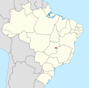
 Location of São Sebastião in the Federal District Location of São Sebastião in the Federal District | |
| Coordinates: 15°54′02″S 47°46′46″W / 15.90056°S 47.77944°W / -15.90056; -47.77944 | |
| Country | |
| Region | Central-West |
| State | |
| Established | 25 June 1993 |
| Government | |
| • Regional administrator | Alan José Valim Maia |
| Area | |
| • Total | 262.7 km (101.4 sq mi) |
| Population | |
| • Total | 119,293 |
| • Density | 450/km (1,200/sq mi) |
| Time zone | UTC-3 (UTC-3) |
| • Summer (DST) | UTC-2 (UTC-2) |
| Area code | +55 61 |
| Website | www |
São Sebastião is an administrative region in the Federal District in Brazil. São Sebastião was founded on June 25, 1993, receiving the status of administrative region, according to Law 467, of June 25, 1993.
See also
References
External links
This Federal District, Brazil geography article is a stub. You can help Misplaced Pages by expanding it. |
