| Sävar | |
|---|---|
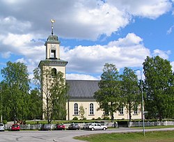
 Sävar Church in June 2007 Sävar Church in June 2007 | |
  | |
| Coordinates: 63°54′N 20°34′E / 63.900°N 20.567°E / 63.900; 20.567 | |
| Country | Sweden |
| Province | Västerbotten |
| County | Västerbotten County |
| Municipality | Umeå Municipality |
| Area | |
| • Total | 2.45 km (0.95 sq mi) |
| Population | |
| • Total | 2,670 |
| • Density | 1,092/km (2,830/sq mi) |
| Time zone | UTC+1 (CET) |
| • Summer (DST) | UTC+2 (CEST) |
Sävar (Swedish pronunciation: [ˈsɛ̂ːvar]) is a locality situated in Umeå Municipality, Västerbotten County, Sweden with 2,670 inhabitants in 2010.
It is located by E4 about 15 km north of Umeå, Sweden, and is mostly known for being the last battlefield of the Finnish War.
References
- ^ "Tätorternas landareal, folkmängd och invånare per km 2005 och 2010" (in Swedish). Statistics Sweden. 14 December 2011. Archived from the original on 27 January 2012. Retrieved 10 January 2012.
- Jöran Sahlgren; Gösta Bergman (1979). Svenska ortnamn med uttalsuppgifter (in Swedish). p. 24.
| Localities in Umeå Municipality, Västerbotten County, Sweden | |
|---|---|
| Localities | |
| Villages | |
This article about a location in Västerbotten County, Sweden is a stub. You can help Misplaced Pages by expanding it. |