You can help expand this article with text translated from the corresponding article in French. (December 2008) Click for important translation instructions.
|
| Saint-Cyprien-sur-Dourdou | |
|---|---|
| Part of Conques-en-Rouergue | |
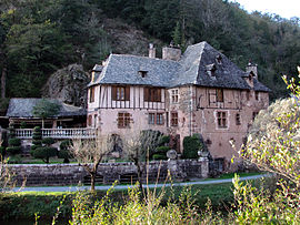
 Former abbatial residence Former abbatial residence | |
 Coat of arms Coat of arms | |
| Location of Saint-Cyprien-sur-Dourdou | |
  | |
| Coordinates: 44°32′53″N 2°24′46″E / 44.5481°N 2.4128°E / 44.5481; 2.4128 | |
| Country | France |
| Region | Occitania |
| Department | Aveyron |
| Arrondissement | Rodez |
| Canton | Lot et Dourdou |
| Commune | Conques-en-Rouergue |
| Area | 30.23 km (11.67 sq mi) |
| Population | 823 |
| • Density | 27/km (71/sq mi) |
| Time zone | UTC+01:00 (CET) |
| • Summer (DST) | UTC+02:00 (CEST) |
| Postal code | 12320 |
| Elevation | 229–645 m (751–2,116 ft) (avg. 248 m or 814 ft) |
| French Land Register data, which excludes lakes, ponds, glaciers > 1 km (0.386 sq mi or 247 acres) and river estuaries. | |
Saint-Cyprien-sur-Dourdou (French pronunciation: [sɛ̃ sipʁijɛ̃ syʁ duʁdu], literally Saint-Cyprien on Dourdou; Occitan: Sent Cebrian) is a former commune in the Aveyron department in southern France. On 1 January 2016, it was merged into the new commune of Conques-en-Rouergue.
Population
| Year | Pop. | ±% |
|---|---|---|
| 1962 | 830 | — |
| 1968 | 925 | +11.4% |
| 1975 | 863 | −6.7% |
| 1982 | 849 | −1.6% |
| 1990 | 778 | −8.4% |
| 1999 | 766 | −1.5% |
| 2008 | 813 | +6.1% |
See also
References
- "Populations légales 2021" [Legal populations 2021] (PDF) (in French). INSEE. December 2023.
- Arrêté préfectoral 19 November 2015
This Aveyron geographical article is a stub. You can help Misplaced Pages by expanding it. |