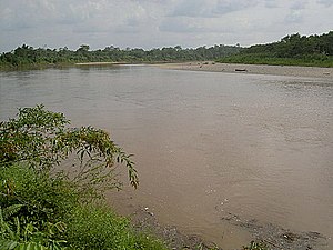
| San Miguel River | |
|---|---|
 | |
| Native name | Río San Miguel (Spanish) |
| Location | |
| Countries | |
| Physical characteristics | |
| Source | Andes Mountains |
| • location | Nariño Department |
| • elevation | 3,000 m (9,800 ft) |
| Mouth | Putumayo River |
| • location | Puerto El Carmen de Putumayo, Colombia |
| • coordinates | 0°07′05″N 75°52′02″W / 0.11806°N 75.86722°W / 0.11806; -75.86722 |
| Length | 295 km (183 mi) |
| Discharge | |
| • location | mouth |
The San Miguel River (Spanish: Río San Miguel) is a river in Colombia and Ecuador. It is a sub-tributary of the Solimões River (middle course of the Amazon) via the Putumayo River.
Geography
The 295-km long San Miguel River rises on the slopes of the Andes Mountains, in the extreme south of the Colombian department of Nariño, on the border between Colombia and Ecuador. It then flows east, marking the border between the two countries, before passing through Ecuador and then joining the Putumayo River, again on the border, from the left at Puerto El Carmen de Putumayo.
References
- "Río San Miguel: Todo lo que necesita saber sobre él". riosdelplaneta.com (in Spanish). Rios del planeta. Archived from the original on 24 January 2022. Retrieved 22 August 2018.
- Collectif (2003). Definicion de Areas Para la Siera de Camru Camu en El Departamento de Putumayo (in Spanish). Corpoica. p. 115. ISBN 958-97143-2-3. Retrieved 22 August 2018..