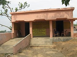
| Satar Kataiya | |
|---|---|
| Tehsil | |
 Village of Hasa Hakpur within the Tehsil Village of Hasa Hakpur within the Tehsil | |
  | |
| Coordinates: 25°56′57″N 86°34′41″E / 25.94917°N 86.57806°E / 25.94917; 86.57806 | |
| Country | |
| State | Bihar |
| Region | Mithila |
| District | Saharsa |
| Villages | 38 |
| Area | |
| • Total | 160 km (60 sq mi) |
| Elevation | 45 m (148 ft) |
| Population | |
| • Total | 151,060 |
| • Density | 940/km (2,400/sq mi) |
| Time zone | UTC+5:30 (IST) |
| PIN | 852124 |
Satar Kataiya (or Sattar Kataiya) is a block in Saharsa District, Bihar, India. Its seat of government is located in the village of Sattar. As of the year 2011, its population is 151,060.
Geography
Satar Kataiya is located on the east of the Kosi River, approximately 8 kilometres north of its district capital Saharsa. Its average elevation is at 45 metres above the sea level.
Administrative divisions
As of 2011, there are a total of 38 villages within the boundary of Satar Kataiya. They are listed as follows:
- Agwanpur
- Aran
- Baghi urf Bhaluasukhasan
- Baijnathpur
- Bara
- Barahser
- Bela
- Bijalpur
- Bishunpur
- Chauri Bijalpur
- Chinwari
- Dahaha Badh
- Gandaul
- Gangaura Behra
- Gobargarha urf jarsain
- Hasa Hakpur
- Itahri
- Kharik Badh
- Lachhminia
- Laukahi
- Makuna
- Matiari Badh
- Nandlali
- Pachgachhia
- Padumpur
- Panidaha
- Patori
- Pipra
- Purikh
- Rakeapatti
- Rohua Arazi
- Sadhua Badh
- Sattar
- Shahpur
- Sihaul
- Sisai
- Tuniahi
- Ukahi
Demographics
| Religion in Satar Kataiya | ||||
|---|---|---|---|---|
| Religion | Percent | |||
| Hinduism | 90.89% | |||
| Islam | 8.98% | |||
| Christianity | 0.04% | |||
| other | 0.09% | |||
In 2011, there are 28,710 households within Satar Kataiya, with a total population of 151,060. Out of the total population, 79,332 are male and 71,728 are female. The total literacy rate is 52.36%, with 51.2% of the male residents and 32.26% of the female population being literate.
See also
References
- "Tehsil | Saharsa District | India". Retrieved 2023-03-26.
- ^ "Basic Population Figures of India, States, Districts, Sub-District and Village, 2011". censusindia.gov.in. Retrieved 2023-03-26.
- "Satar Kataiya topographic map, elevation, terrain". Topographic maps. Retrieved 2023-03-26.
- "Villages & Towns in Satar Kataiya Block of Saharsa, Bihar". www.census2011.co.in. Retrieved 2023-03-26.
| Populated places in Saharsa district | |
|---|---|
| Blocks and subdivisions | |
| Populated places | |