| Schmiedefeld am Rennsteig | |
|---|---|
| Ortsteil of Suhl | |
 | |
 Coat of arms Coat of arms | |
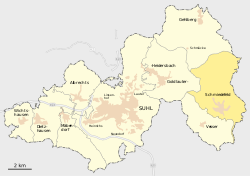
Location of Schmiedefeld am Rennsteig within Suhl
 | |
  | |
| Coordinates: 50°36′32″N 10°48′47″E / 50.60889°N 10.81306°E / 50.60889; 10.81306 | |
| Country | Germany |
| State | Thuringia |
| Town | Suhl |
| Area | |
| • Total | 18.43 km (7.12 sq mi) |
| Elevation | 700 m (2,300 ft) |
| Population | |
| • Total | 1,653 |
| • Density | 90/km (230/sq mi) |
| Time zone | UTC+01:00 (CET) |
| • Summer (DST) | UTC+02:00 (CEST) |
| Postal codes | 98711 |
| Dialling codes | 036782 |
| Website | www.schmiedefeld.de |
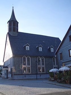
Schmiedefeld am Rennsteig is a village and a former municipality in Thuringia, Germany. Formerly in the district Ilm-Kreis, it is part of the town Suhl since January 2019.
Gallery
-
 Schmiedefeld am Rennsteig in winter
-
 The Chimney sweep, of Schmiedefeld, 1989
References
![]() Media related to Schmiedefeld am Rennsteig at Wikimedia Commons
Media related to Schmiedefeld am Rennsteig at Wikimedia Commons
This Thuringia location article is a stub. You can help Misplaced Pages by expanding it. |