This article is about a community in Brandenburg. For other uses, see Schwarzbach .
Municipality in Brandenburg, Germany
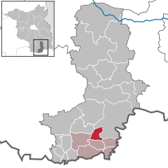
Schwarzbach Schwarzbach is a municipality in the Oberspreewald-Lausitz district, in Upper Lusatia , Brandenburg , Germany .
History
From 1815 to 1824, Schwarzbach was part of the Prussian Province of Brandenburg . From 1825 to 1919 it was part of the Province of Silesia , from 1919 to 1938 of the Province of Lower Silesia , from 1938 to 1941 again of the Province of Silesia and from 1941 to 1945 again of the Province of Lower Silesia. From 1945 to 1952 it was part of Saxony and from 1952 to 1990 of the Bezirk Cottbus of East Germany .
Demography
Development of Population since 1875 within the Current Boundaries (Blue Line: Population; Dotted Line: Comparison to Population Development of Brandenburg state; Grey Background: Time of Nazi rule; Red Background: Time of Communist rule) Schwarzbach: Population development Year Pop. ±% p.a. 1875 540 — 1890 580 +0.48% 1910 750 +1.29% 1925 776 +0.23% 1933 788 +0.19% 1939 840 +1.07% 1946 953 +1.82% 1950 954 +0.03% 1964 868 −0.67% 1971 847 −0.35% 1981 839 −0.09% 1985 768 −2.19% 1989 763 −0.16% 1990 735 −3.67% 1991 708 −3.67% 1992 717 +1.27% 1993 723 +0.84% 1994 730 +0.97% 1995 745 +2.05% 1996 760 +2.01%
Year Pop. ±% p.a. 1997 780 +2.63% 1998 784 +0.51% 1999 786 +0.26% 2000 782 −0.51% 2001 791 +1.15% 2002 803 +1.52% 2003 815 +1.49% 2004 800 −1.84% 2005 778 −2.75% 2006 768 −1.29% 2007 759 −1.17% 2008 759 +0.00% 2009 735 −3.16% 2010 725 −1.36% 2011 701 −3.31% 2012 699 −0.29% 2013 679 −2.86% 2014 679 +0.00% 2015 671 −1.18% 2016 662 −1.34%
References
Landkreis Oberspreewald-Lausitz Wahl der Bürgermeisterin / des Bürgermeisters . Retrieved 3 July 2024.
"Bevölkerungsentwicklung und Bevölkerungsstandim Land Brandenburg Dezember 2022" (PDF). Amt für Statistik Berlin-Brandenburg Population Projection Brandenburg at Wikimedia Commons
Categories :
Text is available under the Creative Commons Attribution-ShareAlike License. Additional terms may apply.
**DISCLAIMER** We are not affiliated with Wikipedia, and Cloudflare.
The information presented on this site is for general informational purposes only and does not constitute medical advice.
You should always have a personal consultation with a healthcare professional before making changes to your diet, medication, or exercise routine.
AI helps with the correspondence in our chat.
We participate in an affiliate program. If you buy something through a link, we may earn a commission 💕
↑


