Town in Victoria, Australia
| Scotts Creek Victoria | |
|---|---|
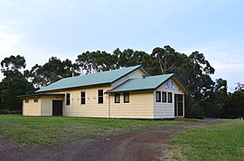
 The Scotts Creek Cowleys Creek Public Hall, 2012 The Scotts Creek Cowleys Creek Public Hall, 2012 | |
 | |
| Coordinates | 38°27′00″S 143°02′59″E / 38.45000°S 143.04972°E / -38.45000; 143.04972 |
| Population | 248 (2016 census) |
| Postcode(s) | 3267 |
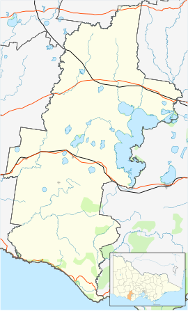
| Location |
|
| LGA(s) | Corangamite Shire |
| State electorate(s) | Polwarth |
| Federal division(s) | Wannon |
Scotts Creek is a locality in south-west Victoria, Australia, in the Corangamite Shire, 210 kilometres (130 mi) south-west of the state capital, Melbourne. Located where the Timboon-Colac Rd intersects the Cobden-Port Campbell Rd, Scotts Creek was a part of the original pastoral run of Daniel Curdie. Later the area was explored by gold prospectors but didn't find anything. Later came the timber workers and then the farmers. In 1886 the area was burnt out by the summer bushfires, but no-one was killed.
In the 1950s the area was the western extent of the Heytesbury Settlement Scheme. The scheme involved the clearing of the Heytesbury Forest to allow for the establishment of a dairy industry in the area. In time the area became one of Australia's most productive dairy regions. The influx of farming families allow the formation of the Scotts Creek Football club. The club competed in the Heytesbury Football Association until it wound up in 1995.
At the 2016 census, Scotts Creek had a population of 248.
The area was again burnt out in the March 2018 bushfire.
References
- ^ Australian Bureau of Statistics (27 June 2017). "Scotts Creek". 2016 Census QuickStats. Retrieved 29 July 2017.

- "Investigation blames termite-riddled power pole for Victoria's St Patrick's Day fire". ABC News. 31 July 2018. Retrieved 11 October 2023.
External links
![]() Media related to Scotts Creek, Victoria at Wikimedia Commons
Media related to Scotts Creek, Victoria at Wikimedia Commons
This article about a location in Barwon South West (region) is a stub. You can help Misplaced Pages by expanding it. |
