| Sharomy | |||||||||||
|---|---|---|---|---|---|---|---|---|---|---|---|
 | |||||||||||
| Summary | |||||||||||
| Airport type | Military | ||||||||||
| Operator | Russian Air Force | ||||||||||
| Location | Sharomy | ||||||||||
| Elevation AMSL | 149 m / 489 ft | ||||||||||
| Coordinates | 54°17′36″N 158°9′6″E / 54.29333°N 158.15167°E / 54.29333; 158.15167 | ||||||||||
| Map | |||||||||||
  | |||||||||||
| Runways | |||||||||||
| |||||||||||
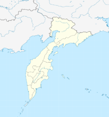
Sharomy (Russian: Шаромы) (also referred to as Sheromy) is a Naval air base in Kamchatka Krai, Russia located about 143 km north of Petropavlovsk-Kamchatsky. Sharomy contains hardstands for 12 bombers and 3 fighters. It is believed to have served as a dispersal airfield for Soviet Naval Aviation, and may also be a staging airfield for Long Range Aviation.
The US intelligence community noted the first appearance of military aircraft at the airfield in September 1967, when three Tupolev Tu-16 were identified on KH-4 satellite imagery. The same report listed the airfield as having a 9950 x 250 ft (3000 x 75 m) graded earth runway and limited support facilities, however the runway was paved and the airfield expanded in the late 1960s or 1970s.
A US intelligence report noted a Naval Aviation Tu-16K Badger-G at the airfield in 1979.
Satellite imagery from early 2018 showed that the runway is plowed in the wintertime, indicating the base remains operational or in caretaker status.
References
- RussianAirFields.com
- CABLE TO DIRNSA FROM NPIC, CIA-RDP78B03817A000800040051-7, Top Secret.
- Annual Index to Photographic Exploitation Products, January–December 1979, February 1980, CIA-RDP80T00913A000200010001-6, Central Intelligence Agency, Washington, DC.
This Russian military article is a stub. You can help Misplaced Pages by expanding it. |