| Shuangliu Forest Recreation Area Chinese: 雙流國家森林遊樂區 | |
|---|---|
 a sign of Shuangliu Forest Recreation Area a sign of Shuangliu Forest Recreation Area | |
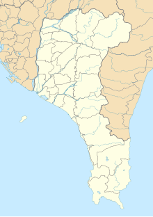
| Map | |
 | |
| Geography | |
| Location | Shizi, Pingtung County, Taiwan |
| Coordinates | 22°12′58.5″N 120°47′58.4″E / 22.216250°N 120.799556°E / 22.216250; 120.799556 |
| Elevation | 175-650 m |
| Area | 6.5 km |
Shuangliu Forest Recreation Area (traditional Chinese: 雙流國家森林遊樂區; simplified Chinese: 双流国家森林游乐区; pinyin: Shuāngliú Guójiā Sēnlín Yóulè Qū) is a forest in Caopu Village, Shizi Township, Pingtung County, Taiwan.
Geology
The forest spans an area of 6.5 square kilometers (2.5 sq mi) at an elevation of 175–650 meters (574–2,133 ft) above sea level and annual mean temperature of 21 °C (70 °F). The highest point of the forest is Mount Maozi.
Facilities
For hiking purpose, the forest consists of four different trails, which are the Banyan trail, mountainside trail, Mount Maozi trail and waterfall trail. It has other facilities such as the Forest Classroom, Power of Nature, a nature center and the Sunshine Lawn.
Transportation
The forest is accessible by bus from Taitung Station of Taiwan Railways.
See also
References
- "Shuangliu Forest Recreation Area in Kenting". roundTAIWANround. Retrieved 31 January 2018.
- "Shuangliu Forest Recreation Area". Pingtung County Government. 26 January 2018. Retrieved 31 January 2018.
- "Shuangliou Forest Recreation Area". Taiwan Forest Recreation. Retrieved 31 January 2018.
- "Shuangliu National Forest Recreation Area". Taiwan, the Heart of Asia. 30 April 2008. Retrieved 31 January 2018.
- ^ Pingtung Forest District Office. "Shuangliou National Forest Recreation Area" (PDF). Taiwan Forest Recreation. Retrieved 31 January 2018.