| Signal Port | |
|---|---|
| Former settlement | |
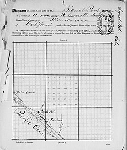
 Map of Signal Port location, 1888 Map of Signal Port location, 1888 | |
 | |
| Coordinates: 38°49′45″N 123°36′56″W / 38.82917°N 123.61556°W / 38.82917; -123.61556 | |
| Country | United States |
| State | California |
| County | Mendocino County |
| Elevation | 108 ft (33 m) |
Signal Port (also, Hardscratch and Signal) is a former settlement in Mendocino County, California. It was located near the mouth of Signal Creek 3.5 miles (5.6 km) northwest of Fish Rock, at an elevation of 108 feet (33 m).
The Signal post office operated for a time in 1882. The Signal Port post office operated from 1888 to 1890. The name refers to signals given ships waiting to load lumber at the site.
References
- ^ U.S. Geological Survey Geographic Names Information System: Signal Port, California
- ^ Durham, David L. (1998). California's Geographic Names: A Gazetteer of Historic and Modern Names of the State. Clovis, Calif.: Word Dancer Press. p. 143. ISBN 1-884995-14-4.
| Municipalities and communities of Mendocino County, California, United States | ||
|---|---|---|
| County seat: Ukiah | ||
| Cities |  | |
| CDPs | ||
| Unincorporated communities |
| |
| Indian reservations | ||
| Former settlements | ||
| Footnotes | ‡This populated place also has portions in an adjacent county or counties | |
This Mendocino County, California–related article is a stub. You can help Misplaced Pages by expanding it. |