| This article needs additional citations for verification. Please help improve this article by adding citations to reliable sources. Unsourced material may be challenged and removed. Find sources: "Sion, Netherlands" – news · newspapers · books · scholar · JSTOR (December 2009) (Learn how and when to remove this message) |
| Sion | |
|---|---|
| Buurtschap | |
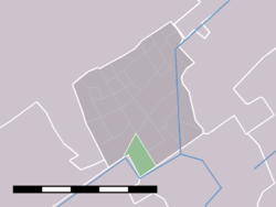
 locatie Sion in Rijswijk locatie Sion in Rijswijk | |
| Coordinates: 52°1′7″N 4°19′30″E / 52.01861°N 4.32500°E / 52.01861; 4.32500 | |
| Country | Netherlands |
| Province | South Holland |
| Municipality | Rijswijk |
| Area | |
| • Total | 0.79 km (0.31 sq mi) |
| Population | 190 |

Sion is a hamlet in the Dutch municipality of Rijswijk. It is located on the border with Delft.
In 1345, the monastery Sancta Maria in Monte Sion was built in this area. It was demolished on the orders of the city of Delft in 1572, when Spanish troops approached the city, and was never rebuilt. In the 17th century, an estate was built on the grounds of the former monastery, and in the 19th century, it was divided into small parts and made into farms.
Since 2013, Rijswijk has started construction of several new neighborhoods in the area formerly called Sion.
References
52°0′51″N 4°19′30″E / 52.01417°N 4.32500°E / 52.01417; 4.32500
This South Holland location article is a stub. You can help Misplaced Pages by expanding it. |