Human settlement in England
| Stainton | |
|---|---|
 Stainton Stainton | |
  | |
| Area | 0.4025 km (0.1554 sq mi) |
| Population | 758 (2019 estimate) |
| • Density | 1,883/km (4,880/sq mi) |
| OS grid reference | NY483793 |
| Civil parish | |
| Unitary authority | |
| Ceremonial county | |
| Region | |
| Country | England |
| Sovereign state | United Kingdom |
| Post town | PENRITH |
| Postcode district | CA11 |
| Dialling code | 01768 |
| Police | Cumbria |
| Fire | Cumbria |
| Ambulance | North West |
| UK Parliament | |
| 54°38′35″N 2°47′56″W / 54.643°N 2.799°W / 54.643; -2.799 | |
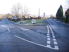
Stainton is a village near the A66, in the parish of Dacre, in the Westmorland and Furness district, in the English county of Cumbria. It is a few miles away from the market town of Penrith. It is in the parish of Dacre, although it is larger than Dacre. It has a Methodist church and a primary school. In 2019 the built-up area had an estimated population of 758. In 1870-72 the township had a population of 330.
See also
References
- "Stainton Methodist Church". Penrith Methodist Church. Retrieved 12 June 2021.
- "Home". Stainton C of E Primary School. Retrieved 12 June 2021.
- "Stainton". City Population De. Retrieved 12 June 2021.
- "History of Stainton, in Eden and Cumberland". A Vision of Britain through Time. Retrieved 13 January 2022.
- Philip's Street Atlas Cumbria
External links
- Cumbria County History Trust: Dacre (nb: provisional research only - see Talk page)
- https://web.archive.org/web/20110927181615/http://www.axcis.co.uk/schools-directory/Stainton-CE-Primary-School/43428
- Lake District Walks
This Cumbria location article is a stub. You can help Misplaced Pages by expanding it. |