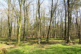
| Staple Hill | |
|---|---|
 Staple Hill Plantations Staple Hill Plantations | |
| Highest point | |
| Elevation | 315 m (1,033 ft) |
| Prominence | 212 m (696 ft) |
| Parent peak | Dunkery Beacon |
| Listing | Marilyn, Hardy |
| Geography | |
| Location | Blackdown Hills, England |
| OS grid | ST240166 |
| Topo map | OS Landranger 193 |
Staple Hill is a hill in the English county of Somerset, the highest point in the Blackdown Hills. It is classed as both a Marilyn and a Hardy.
This is one of the points on the Staple Fitzpaine Herepath a part of Forestry England woodlands.
There is a loop walk, starting from the car parking area, of 800m taking in a couple of view points with the paths upgraded early in 2009 to be suitable for disabled access.
References
- "All High Points Height Order" (PDF). The Hardys. p. 65. Retrieved 30 June 2015.
- "Staple Hill Car Park". Forestry England. Retrieved 30 June 2015.
50°56′38″N 3°04′59″W / 50.94381°N 3.08314°W / 50.94381; -3.08314
This Somerset location article is a stub. You can help Misplaced Pages by expanding it. |