| Starrucca Creek | |
|---|---|
 Starrucca Creek flowing under Starrucca Viaduct Starrucca Creek flowing under Starrucca Viaduct | |
  | |
| Location | |
| Country | United States |
| State | Pennsylvania |
| Physical characteristics | |
| Mouth | Susquehanna River |
| • location | Near Lanesboro |
| • coordinates | 41°55′41″N 75°31′00″W / 41.92809°N 75.51675°W / 41.92809; -75.51675 |
| Length | 18.1 mi (29.1 km) |
| Basin features | |
| Progression | Starrucca Creek → Susquehanna River → Chesapeake Bay → Atlantic Ocean |
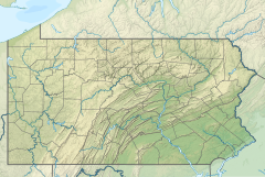
Starrucca Creek is an 18.1-mile-long (29.1 km) tributary of the Susquehanna River in Susquehanna and Wayne counties, Pennsylvania in the United States. Shadigee Creek joins Starrucca Creek just downstream of Starrucca. Soon after passing under the Starrucca Viaduct, Starrucca Creek joins the Susquehanna near the borough of Lanesboro.
The former Stone Arch Bridge crossed Starrucca Creek at the borough of Starrucca.
See also
References
- U.S. Geological Survey. National Hydrography Dataset high-resolution flowline data. The National Map, accessed August 8, 2011
- ^ Gertler, Edward. Keystone Canoeing, Seneca Press, 2004. ISBN 0-9749692-0-6
- "National Register Information System". National Register of Historic Places. National Park Service. July 9, 2010.
This Susquehanna County, Pennsylvania state location article is a stub. You can help Misplaced Pages by expanding it. |
This Wayne County, Pennsylvania state location article is a stub. You can help Misplaced Pages by expanding it. |
This article related to a river in Pennsylvania is a stub. You can help Misplaced Pages by expanding it. |


