| Stella Maris Airport | |||||||||||
|---|---|---|---|---|---|---|---|---|---|---|---|
| Summary | |||||||||||
| Airport type | Public | ||||||||||
| Serves | Long Island, Bahamas | ||||||||||
| Location | Stella Maris | ||||||||||
| Elevation AMSL | 10 ft / 3 m | ||||||||||
| Coordinates | 24°33′53″N 075°16′14″W / 24.56472°N 75.27056°W / 24.56472; -75.27056 | ||||||||||
| Map | |||||||||||
 | |||||||||||
| Runways | |||||||||||
| |||||||||||
| Source: DAFIF | |||||||||||
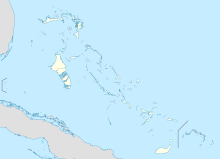
Stella Maris Airport (IATA: SML, ICAO: MYLS) is an airport located near Stella Maris on Long Island in The Bahamas.
Facilities
The airport resides at an elevation of 10 ft (3.0 m) above mean sea level. It has one runway designated 13/31 with an asphalt surface measuring 1,219 m × 23 m (3,999 ft × 75 ft).
The airport was designed and built by Jack Henry Cordery who was engaged by Stella Maris Estate Company in 1967 when he emigrated from England to take the job of Estate Development Manager. He died on Long Island in 1968 and is buried there.
Airlines and destinations
| Airlines | Destinations |
|---|---|
| Southern Air Charter | Deadman's Cay, Nassau |
| Makers Air | Fort Lauderdale Executive Airport |
Historical airline service
Stella Maris Airport was served in the past by Bahamasair which operated regional turboprop airliners on nonstop flights primarily to Nassau. According to the Official Airline Guide (OAG), in 1975 Bahamasair was serving the airport with Fairchild Hiller FH-227 aircraft which were then replaced with new Hawker Siddeley HS 748 aircraft in 1979. By 1999, Bahamasair was operating de Havilland Canada DHC-8 Dash 8 series 300 aircraft into the airport according to the OAG. Bahamasair no longer serves the airport but does currently serve the island's the other airfield, Deadman's Cay Airport near Clarence Town.
References
- ^ "Airport information for MYLS". World Aero Data. Archived from the original on 2019-03-05.
{{cite web}}: CS1 maint: unfit URL (link) Data current as of October 2006. Source: DAFIF. - Airport information for SML at Great Circle Mapper. Source: DAFIF (effective October 2006).
- http://www.departedflights.com, April 15, 1975; Nov. 15, 1979; June 1, 1999 Official Airline Guide (OAG) editions, Nassau flight schedules
- "Bahamasair - the National Flag Carrier of the Bahamas". Archived from the original on 2018-05-19. Retrieved 2018-05-18.
External links
This article about a Caribbean airport is a stub. You can help Misplaced Pages by expanding it. |
This article about a Bahamian building or structure related topic is a stub. You can help Misplaced Pages by expanding it. |