| Stenlille | |
|---|---|
| Town | |
 Stenlille railway station Stenlille railway station | |
  | |
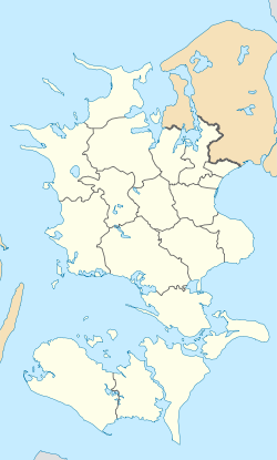
| Coordinates: 55°32′20″N 11°35′30″E / 55.53889°N 11.59167°E / 55.53889; 11.59167 | |
| Country | Denmark |
| Region | Region Zealand |
| Municipality | Sorø Municipality |
| Area | |
| • Urban | 1.3 km (0.5 sq mi) |
| Population | |
| • Urban | 2,048 |
| • Urban density | 1,600/km (4,100/sq mi) |
| Time zone | UTC+1 (CET) |
| • Summer (DST) | UTC+2 (CEST) |
| Postal code | DK-4295 Stenlille |
Stenlille is a railway town, with a population of 2,048 (1 January 2024), in Sorø Municipality, Region Zealand in Denmark.
Stenlille was the municipal seat of the former Stenlille Municipality until 1 January 2007.
Stenlille is served by Stenlille railway station on the Tølløse railway line.

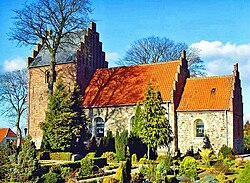
Stenlille Church is located in the southern part of the town.
One of Denmark's two underground sites for natural gas storage is located near Stenlille. In operation since 1989, it has a capacity of 3 billion cubic meters.
References
- ^ BY3: Population 1. January by urban areas, area and population density The Mobile Statbank from Statistics Denmark
- Stenlille Kirke
- GEUS
- Laier & Øbro 2009, p. 81.
Sources
- Laier, T.; Øbro, H. (2009). "Environmental and safety monitoring of the natural gas underground storage at Stenlille, Denmark". Geological Society, London, Special Publications. 313 (1): 81–92. doi:10.1144/SP313.6. ISSN 0305-8719.
This Denmark-related article is a stub. You can help Misplaced Pages by expanding it. |