| Stonewall Pond | |
|---|---|
 | |
 | |
| Location | Chilmark, Massachusetts |
| Coordinates | 41°19′35″N 70°45′25″W / 41.32639°N 70.75694°W / 41.32639; -70.75694 |
| Type | Salt Pond |
| Basin countries | United States |
| Surface area | 30 acres (12 ha) |
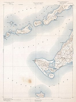
Stonewall Pond is a salt pond in the town of Chilmark, Massachusetts. Stonewall Pond connects to Menemsha Pond via Nashaquitsa Pond. The beach that separates Stonewall Pond from the Atlantic Ocean is called Stonewall Beach.
Ecosystem
History
Archeological exploration indicates that indigenous peoples of the Wampanoag tribe have inhabited the shores of Stonewall Pond and the neighboring ponds for approximately 10,000 to 7,500 years. In his 1969 book, Archaeology of Martha's Vineyard, William A Ritchie excavated and carbon-dated materials found in the shell middens and living sites around the Vineyard including Stonewall Pond.
Storms
It is not uncommon during big storms for the Atlantic Ocean to breach Stonewall Beach and enter the Menemsha Pond ecosystem via Stonewall Pond. In the historic 1938 New England hurricane, the Atlantic Ocean entered the ponds through Stonewall and decimated any buildings near the water, including almost the entire fishing village of Menemsha.
Marine life
In an early 1990s report by the Martha's Vineyard Commission, Stonewall Pond was observed to host shellfish including soft shell clams, scallops, quahogs, blue crabs, and eels. In this same report, the entire acreage of Stonewall Pond is designated an eelgrass resource.
References
- ^ Martha’s Vineyard Commission. "AMENDED DECISION OF THE MARTHA'S VINEYARD COMMISSION DESIGNATING THE MEMEMSHA, NASHAQUITSA AND STONEWALL PONDS DISTRICT AS A DISTRICT OF CRITICAL PLANNING CONCERN" (PDF).
- ^ Burns, Cherie (June 2006). The Great Hurricane: 1938. Grove Press. ISBN 978-0-8021-4254-2.
- "Where Has All the Quitsa Eelgrass Gone? Crabs and Geese May Be to Blame". The Vineyard Gazette - Martha's Vineyard News. Retrieved 2020-05-02.
- "Chilmark Scallopers Husband Resources". The Vineyard Gazette - Martha's Vineyard News. Retrieved 2020-05-02.
- "Special Conservation District Declared for Menemsha and Nashaquitsa Ponds". The Vineyard Gazette - Martha's Vineyard News. Retrieved 2020-05-02.
- "Stonewall's Anomalies". Martha's Vineyard Magazine. 2009-09-01. Retrieved 2020-05-02.
- Hufstader, Louisa. "Aquinnah Sites Reveal 10,000 Years of Wampanoag History". The Vineyard Gazette.
- Ritchie, William A. (1969). Archaeology of Martha's Vineyard. NY.
{{cite book}}: CS1 maint: location missing publisher (link) - "Nashaquitsa Pond". Mapcarta. Retrieved 2020-05-02.
This Dukes County, Massachusetts geography–related article is a stub. You can help Misplaced Pages by expanding it. |