| Storhøa | |
|---|---|
   | |
| Highest point | |
| Elevation | 1,921 m (6,302 ft) |
| Prominence | 411 m (1,348 ft) |
| Isolation | 6.1 km (3.8 mi) |
| Coordinates | 62°10′39″N 7°59′01″E / 62.17738°N 7.98362°E / 62.17738; 7.98362 |
| Geography | |
| Location | Innlandet and Møre og Romsdal, Norway |
| Parent range | Dovrefjell |
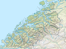
Storhøa is a mountain in Norway. The mountain peak is a tripoint on the border between the municipalities of Rauma (in Møre og Romsdal county) and Lesja and Skjåk (in Innlandet county). The 1,921-metre (6,302 ft) tall mountain lies within Reinheimen National Park, about 21 kilometres (13 mi) east-northeast of the village of Lesjaskog. The mountain is surrounded by several other mountains including Trollkyrkja and Benkehøa to the west, Sponghøi to the south, and Digerkampen to the southeast.
See also
References
- "Storhø, Rauma" (in Norwegian). yr.no. Retrieved 10 April 2022.
- ^ "Storhøa". PeakVisor.com. Retrieved 10 April 2022.
This article about a mountain, mountain range, or peak in Innlandet is a stub. You can help Misplaced Pages by expanding it. |
This article about a mountain, mountain range, or peak in Møre og Romsdal is a stub. You can help Misplaced Pages by expanding it. |