| Subprefecture of Parelheiros | |
|---|---|
| Subprefecture | |
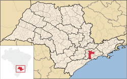
 Location of the Subprefecture of Parelheiros in São Paulo Location of the Subprefecture of Parelheiros in São Paulo | |
 Location of municipality of São Paulo within the State of São Paulo Location of municipality of São Paulo within the State of São Paulo | |
| Country | |
| Region | Southeast |
| State | |
| Municipality | |
| Administrative Zone | South |
| Districts | Parelheiros, Marsilac |
| Government | |
| • Type | Subprefecture |
| • Subprefect | Noel Miranda Castro |
| Area | |
| • Total | 360.6 km (139.2 sq mi) |
| Population | |
| • Total | 148,239 |
| Website | Subprefecture of Parelheiros (Portuguese) |
The Subprefecture of Parelheiros is one of 32 subprefectures of the city of São Paulo, Brazil. It comprises two districts: Parelheiros and Marsilac.
It's the southernmost, least populated and poorest borough of São Paulo. Most of its area is rural, covered by parts of the Atlantic Rainforest.
Public Equipment
See also
- Line 9 of Train (CPTM)
- Roman Catholic Diocese of Santo Amaro
- Parelheiros-Itanhaém Highway 57
- Guarapiranga Reservoir
- Colônia crater
References
External links
- Subprefecture of Parelheiros
- Roman Catholic Diocese of Santo Amaro
- Official page of the São Paulo Metropolitan Trains Company
23°51′S 46°44′W / 23.850°S 46.733°W / -23.850; -46.733
Category: