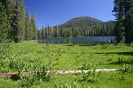
| Summit Lake | |
|---|---|
 | |
  | |
| Location | Lassen Volcanic National Park Shasta County, California |
| Coordinates | 40°29′34″N 121°25′24″W / 40.4927°N 121.4233°W / 40.4927; -121.4233 |
| Type | Glacial lake |
| Primary outflows | Summit Creek |
| Basin countries | United States |
| Surface elevation | 6,680 ft (2,036 m) |
| References | U.S. Geological Survey Geographic Names Information System: Summit Lake |
Summit Lake is a lake in the Lassen Volcanic National Park of Shasta County, California, east of California Route 89 at elevation 6,700 ft (2,000 m). Two campgrounds, named Summit Lake North and Summit Lake South, are located adjacent to the lake.
See also
References
- "Summit Lake, USGS READING PEAK (CA) Topo Map". USGS Quad maps. TopoQuest.com. Retrieved 2008-07-04.
External links
This Shasta County, California-related article is a stub. You can help Misplaced Pages by expanding it. |