Place in Yukon, Canada
| Tagish | |
|---|---|
 Seagull on Tagish Bridge, 2003 Seagull on Tagish Bridge, 2003 | |
 | |
| Coordinates: 60°18′N 134°16′W / 60.300°N 134.267°W / 60.300; -134.267 | |
| Country | Canada |
| Territory | Yukon |
| Population | |
| • Total | 311 |
| Time zone | UTC−07:00 (MST) |
| Area code | 867 |

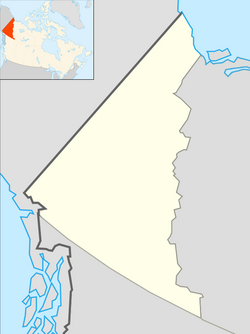
Tagish is an unincorporated community in Yukon, Canada. It is 30 kilometres (19 mi) east of Carcross, Yukon, on the Tagish Road at the northern end of Tagish Lake. The greater Tagish area also includes the Tagish Estates, Tagish Beach and Taku subdivisions, the latter two developed for cottages but now serving for many year-round homes. (California Beach is a part of Tagish Beach subdivision.) Tagish Beach and Taku have their own community hall. The Tagish Road was built in 1942 as part of an oil pipeline project, and the community sprouted around a bridge built over the narrow water between Tagish Lake and Marsh Lake.
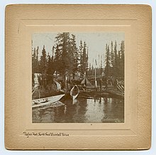
A previous community known as Tagish was located about 3 km (2 mi) south of the current community, along Tagish Lake. The North-West Mounted Police maintained a post in that community during the Klondike Gold Rush.
The area code for Yukon is 867. In it, Tagish is served by prefix 399.
Demographics
| Year | Pop. | ±% |
|---|---|---|
| 1981 | 89 | — |
| 1986 | 103 | +15.7% |
| 1991 | 58 | −43.7% |
| 1996 | 69 | +19.0% |
| 2001 | 206 | +198.6% |
| 2006 | 222 | +7.8% |
| 2011 | 391 | +76.1% |
| 2016 | 249 | −36.3% |
| 2021 | 311 | +24.9% |
| Source: Statistics Canada | ||
In the 2021 Census of Population conducted by Statistics Canada, Tagish had a population of 311 living in 164 of its 413 total private dwellings, a change of 24.9% from its 2016 population of 249. With a land area of 45.26 km (17.47 sq mi), it had a population density of 6.9/km (17.8/sq mi) in 2021.
References
- ^ Tagish (Yukon), The Canadian Encyclopedia, Retrieved 3 December 2018
- "1986 Census: Population - Census Divisions and Census Subdivisions" (PDF). Statistics Canada. September 1987. Retrieved January 30, 2022.
- "91 Census: Census Divisions and Census Subdivisions - Population and Dwelling Counts" (PDF). Statistics Canada. April 1992. Retrieved January 30, 2022.
- "96 Census: A National Overview - Population and Dwelling Counts" (PDF). Statistics Canada. April 1997. Retrieved January 30, 2022.
- "Population and Dwelling Counts, for Canada, Provinces and Territories, and Census Subdivisions (Municipalities), 2001 and 1996 Censuses - 100% Data (Yukon Territory)". Statistics Canada. August 15, 2012. Retrieved January 30, 2022.
- "Population and dwelling counts, for Canada, provinces and territories, and census subdivisions (municipalities), 2006 and 2001 censuses - 100% data (Yukon Territory)". Statistics Canada. August 20, 2021. Retrieved January 30, 2022.
- "Population and dwelling counts, for Canada, provinces and territories, and census subdivisions (municipalities), 2011 and 2006 censuses (Yukon)". Statistics Canada. July 25, 2021. Retrieved January 30, 2022.
- "Population and dwelling counts, for Canada, provinces and territories, and census subdivisions (municipalities), 2016 and 2011 censuses – 100% data (Yukon)". Statistics Canada. February 8, 2017. Retrieved January 30, 2022.
- ^ "Population and dwelling counts: Canada, provinces and territories, and census subdivisions (municipalities), Yukon". Statistics Canada. February 9, 2022. Retrieved February 18, 2022.
External links
This article about a Yukon location is a stub. You can help Misplaced Pages by expanding it. |