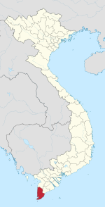
| Tam Giang Tây | |
|---|---|
| Commune and village | |
 | |
 | |
| Coordinates: 8°44′43″N 105°08′08″E / 8.7453°N 105.1356°E / 8.7453; 105.1356 | |
| Country | |
| Province | Cà Mau |
| District | Ngọc Hiển |
| Area | |
| • Total | 35.66 sq mi (92.35 km) |
| Population | |
| • Total | 9,157 |
| Time zone | UTC+07:00 |
Tam Giang Tây is a commune (xã) and village in Ngọc Hiển district, Cà Mau province, in Vietnam. The commune covers an area of 92.35 square kilometres (35.66 sq mi) and as of 2019 it had a population of 9157 people.
| Cà Mau province | ||
|---|---|---|
| Cà Mau |  | |
| Cái Nước | ||
| Đầm Dơi | ||
| Năm Căn | ||
| Ngọc Hiển | ||
| Phú Tân | ||
| Thới Bình | ||
| Trần Văn Thời | ||
| U Minh | ||
This article about a location in Cà Mau province, Vietnam is a stub. You can help Misplaced Pages by expanding it. |