| Tarsia Greek: Tharsías | |
|---|---|
| Comune | |
| Comune di Tarsia | |
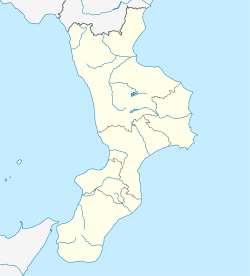
| Location of Tarsia | |
  | |
| Coordinates: 39°37′N 16°16′E / 39.617°N 16.267°E / 39.617; 16.267 | |
| Country | Italy |
| Region | Calabria |
| Province | Cosenza (CS) |
| Government | |
| • Mayor | Roberto Ameruso |
| Area | |
| • Total | 48.28 km (18.64 sq mi) |
| Elevation | 192 m (630 ft) |
| Population | |
| • Total | 2,272 |
| • Density | 47/km (120/sq mi) |
| Demonym | Tarsiani or Tarsioti |
| Time zone | UTC+1 (CET) |
| • Summer (DST) | UTC+2 (CEST) |
| Postal code | 87040 |
| Dialing code | 0981 |
| ISTAT code | 078145 |
| Patron saint | St. Francis of Paola |
| Saint day | Last Sunday in May |
| Website | Official website |
Tarsia is a town and comune in the province of Cosenza in the Calabria region of southern Italy. The ancient town of Caprasia is thought to be the modern Tarsia.
Geography
The municipality borders with Bisignano, Corigliano Calabro, Roggiano Gravina, San Demetrio Corone, San Lorenzo del Vallo, San Marco Argentano, Santa Sofia d'Epiro, Spezzano Albanese and Terranova da Sibari.
History
During World War II, Benito Mussolini built Italy's largest fascist concentration camp there, the Ferramonti internment camp. Imprisoned there were mainly Jews and ethnic minorities considered as enemies by the fascist regime. The camp was liberated by the British on September 14, 1943.
See also
References
- "Superficie di Comuni Province e Regioni italiane al 9 ottobre 2011". Italian National Institute of Statistics. Retrieved 16 March 2019.
- All demographics and other statistics from the Italian statistical institute (Istat)
This Calabrian location article is a stub. You can help Misplaced Pages by expanding it. |