| Taum Sauk Mountain State Park | |
|---|---|
 The highest point in Missouri: Taum Sauk summit The highest point in Missouri: Taum Sauk summit | |
  | |
| Location | Iron and Reynolds counties, Missouri, United States |
| Coordinates | 37°34′17″N 90°43′45″W / 37.57139°N 90.72917°W / 37.57139; -90.72917 |
| Area | 8,732.23 acres (35.3381 km) |
| Elevation | 1,772 ft (540 m) |
| Designation | Missouri state park |
| Established | 1991 |
| Visitors | 144,160 (in 2017) |
| Administrator | Missouri Department of Natural Resources |
| Website | Taum Sauk Mountain State Park |
Taum Sauk Mountain State Park is a Missouri state park located in the St. Francois Mountains in the Ozarks. The park encompasses Taum Sauk Mountain, the highest point in the state. The Taum Sauk portion of the Ozark Trail connects the park with nearby Johnson's Shut-ins State Park and the Bell Mountain Wilderness Area, which together are part of a large wilderness area popular with hikers and backpackers.
In 2005, the Taum Sauk Hydroelectric Power Station was damaged and a billion gallons of water flooded parts of the park and other nearby areas.
Activities and amenities
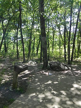
The park has a rustic campground, a paved trail to the highpoint, picnic facilities, and a lookout tower providing a view of the dense mountain forest obscured from other vantage points.
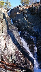
Mina Sauk Falls
Mina Sauk Falls, the highest waterfall in Missouri, is reached via a rugged trail that makes a three-mile (5 km) loop from the highpoint parking area. The falls have cascading waters only during times of wet weather; at other times they are reduced to a trickle or less.
-
 The contiguous Taum Sauk Mountain and Johnson's Shut-ins state parks consist of 16,050 acres (65.0 km) in the Missouri Ozarks.
-
High point plaque on Taum Sauk
-
 Mina Sauk Falls
References
- ^ "Taum Sauk Mountain". Geographic Names Information System. United States Geological Survey, United States Department of the Interior.
- ^ "Taum Sauk Mountain State Park: Data Sheet" (PDF). Missouri Department of Natural Resources. November 2017. Retrieved April 25, 2018.
- "State Park Land Acquisition Summary". Missouri State Parks. Retrieved August 14, 2015.
- "Taum Sauk Mountain State Park". Missouri Department of Natural Resources. Retrieved September 8, 2014.
- "Taum Sauk Section". The Ozark Trail. Ozark Trail Association. Retrieved September 8, 2014.
- 10 years since Taum Sauk dam gave way
- "St. Francois Mountains Natural Area". Missouri Department of Conservation. Retrieved April 25, 2018.
- "Taum Sauk Mountain State Park: Trails". Missouri Department of Natural Resources. Retrieved September 8, 2014.
External links
- Taum Sauk Mountain State Park Missouri Department of Natural Resources
- Taum Sauk Mountain State Park Map Missouri Department of Natural Resources