| Têt | |
|---|---|
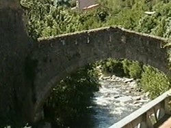
 Têt near Villefranche-de-Conflent Têt near Villefranche-de-Conflent | |
 | |
| Native name | La Têt (French) |
| Location | |
| Country | France |
| Physical characteristics | |
| Source | |
| • location | Pyrenees |
| • elevation | ±2,400 m (7,900 ft) |
| Mouth | |
| • location | Mediterranean Sea |
| • coordinates | 42°42′48″N 3°2′23″E / 42.71333°N 3.03972°E / 42.71333; 3.03972 |
| Length | 115 km (71 mi) |
| Basin size | 1,550 km (600 sq mi) |
| Discharge | |
| • average | 7.5 m/s (260 cu ft/s) |
The Têt (French: [tɛt] ; Catalan: Tet [ˈtɛt]) is the largest river in Pyrénées-Orientales, southwestern France. It is 115 kilometres (71 mi) long. The Têt has its source at the foot of the Puig de la Cometa de l'Espagne in the Carlit massif in the eastern Pyrenees. It crosses the Pyrénées-Orientales département (Northern Catalonia) from West to East and ends in the Mediterranean Sea, near Perpignan (Catalan: Perpinyà).

Tributaries include
Towns along the river
- Mont-Louis (Montlluís)
- Olette (Oleta)
- Villefranche-de-Conflent (Vilafranca de Conflent)
- Prades (Prada de Conflent)
- Perpignan (Perpinyà)
- Ille-sur-Têt (Illa)
References
This Pyrénées-Orientales geographical article is a stub. You can help Misplaced Pages by expanding it. |
This article related to a river in France is a stub. You can help Misplaced Pages by expanding it. |