| Thorswood | |
|---|---|
 | |
 | |
| Location | near Stanton, Staffordshire |
| OS grid | SK 113 470 |
| Coordinates | 53°01′12″N 1°49′55″W / 53.020°N 1.832°W / 53.020; -1.832 |
| Area | 81 hectares (200 acres) |
| Operated by | Staffordshire Wildlife Trust |
| Website | Thorswood |
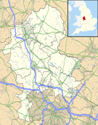
Thorswood is a nature reserve of the Staffordshire Wildlife Trust, situated in the Weaver Hills near the village of Stanton, in Staffordshire, England. It is a Site of Special Scientific Interest.
Description

Its area is 81 hectares (200 acres); the terrain is steep in places.
There are hay meadows on low-lying ground, where ox-eye daisy, knapweed and betony may be found with the tall grasses. On the limestone grassland of the higher ground, there are low-growing flowering plants including salad burnet, cowslip and wild thyme.
Instead of intensive farming practices, there is light grazing and traditional farming techniques, some fields being mown to make hay; the grazing and mowing prevents the grass becoming overgrown and smothering the rarer plants.
History and prehistory
There are three Bronze Age bowl barrows within the reserve; they are scheduled monuments. Lead mining, dating back to the 17th century, took place at Thorswood; the remains of this activity survive in parts of the reserve as extensive hillocks, up to 3 metres (9.8 ft) high, and a number of shafts have been identified. The remains are a scheduled monument. Visitors to the reserve are advised to keep to the marked trails where indicated, in order to avoid mineshafts.
References
- ^ "Thorswood" Staffordshire Wildlife Trust. Retrieved 29 September 2020.
- "Thorswood Nature Reserve, North Staffordshire. Archaeological Desk-Based Assessment and Survey" Archaeology Data Service. Retrieved 1 October 2020.
- Historic England. "Thorswood Mines (1412506)". National Heritage List for England. Retrieved 29 September 2020.
![]() Media related to Thorswood at Wikimedia Commons
Media related to Thorswood at Wikimedia Commons