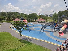
| Titiwangsa Lake Park | |
|---|---|
| Taman Tasik Titiwangsa | |
 View from Titiwangsa Lake Park View from Titiwangsa Lake Park | |
| Type | Urban park |
| Location | Kuala Lumpur, Malaysia |
| Coordinates | 3°10′41″N 101°42′28″E / 3.17806°N 101.70778°E / 3.17806; 101.70778 |
| Area | 46.13 hectares (114.0 acres) |
| Established | February 1, 1980 (1980-02-01) |
Titiwangsa Lake Park (Malay: Taman Tasik Titiwangsa) is an urban park in Titiwangsa, Kuala Lumpur, Malaysia.
History
The gardens feature a large central lake that was a byproduct of tin mining activities under British Rule. Later on, the area was cleaned up and developed into a park. The name Titiwangsa was chosen because Titiwangsa is a mountain range that forms the backbone of Peninsular Malaysia. Before that, the park was named after Taman Jalan Kuantan. The name felt appropriate because the view of the park's flat land and its greenery reflected the scenery and climate of the mountain range.
Architecture


The park spreads across an area of 95 hectares (230 acres) with a 57-hectare (140-acre) of lake. The lake garden has facilities such as a jogging track, cycling track, kayaking, horse riding facility, radio-controlled car racing track etc.
Transport
The lake garden is within walking distance from Entrance B of the PY18 Hospital Kuala Lumpur MRT station served by the MRT Putrajaya Line.
See also
References
- "Titiwangsa Lake Gardens". Malaysia Traveller. Retrieved 1 November 2016.
- "01/02/1980 - PENGISYTIHARAAN NAMA BARU TAMAN JALAN KUANTAN (TAMAN TASIK TITIWANGSA)". hariinidalamsejarah.com. Retrieved 29 August 2022.
- "Titiwangsa Park". Visit KL. Tourism Unit, Kuala Lumpur City Hall. Retrieved 1 November 2016.
- ^ "Titiwangsa Lake Garden (Taman Tasik Titiwangsa)". Attractions in Malaysia. Retrieved 1 November 2016.
External links
- Titiwangsa Park Lake gardens activities pricing and other information
This Malaysian location article is a stub. You can help Misplaced Pages by expanding it. |