Town in Victoria, Australia
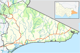
Tongio is a town in Victoria, Australia. It is located on the Great Alpine Road, south of Omeo. At the 2016 census, Tongio recorded a population of 65.
History
Tongio's namesake is the Aboriginal Tongio Munjie, and the town was first settled in 1839 by Codie Buckley. While there is no record of when the Tongio hotel was built, the earliest license was granted on 17 November 1884 to Jack Weston.
Demographics
As of the 2016 Australian census, 65 people resided in Tongio. The median age of persons in Tongio was 58 years. There were more males than females, with 56.7% of the population male and 43.3% female. The average household size was 2.4 people per household.
References
- Australian Bureau of Statistics (28 June 2022). "Tongio (suburb and locality)". Australian Census 2021 QuickStats. Retrieved 28 June 2022.

- "Find a postcode". Australia Post.
- ^ Australian Bureau of Statistics (27 June 2017). "Tongio (State Suburb)". 2016 Census QuickStats. Retrieved 1 December 2020.

- Fairweather, Keith McDonald (1975). Time to Remember: The History of Gold Mining on the Tambo and Its Tributaries. p. 298. ISBN 9780959730906. Retrieved 1 December 2020.
This article about a location in Gippsland (region) is a stub. You can help Misplaced Pages by expanding it. |

