| Tortuguero Volcano | |
|---|---|
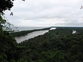
 View towards the southeast from Tortuguero Volcano View towards the southeast from Tortuguero Volcano | |
| Highest point | |
| Elevation | 119 metres (390 ft) |
| Coordinates | 10°35′04″N 83°31′40″W / 10.584327°N 83.527759°W / 10.584327; -83.527759 |
| Geography | |
 | |
| Geology | |
| Mountain type | Volcano |
| Last eruption | Unknown |
Tortuguero Volcano, also known as Tortuguero Hill (Spanish: Cerro Tortuguero), is an extinct volcano located 5.5 kilometres (3.4 mi) WNW from Tortuguero, Costa Rica.
Toponymy
It shares its name, which means "many turtles", with the town and the Tortuguero National Park.
Physical aspects
Pyroclastic cone, one of its sides was cut when the nearby canals were created.
Social and economic activity
The volcano can be seen from the touristic areas of Tortuguero.
See also
References
- ^ Alvarado Induni, Guillermo. Los volcanes de Costa Rica. Editorial de la Universidad Estatal a Distancia. pp. 200–201. ISBN 978-9968-316-79-8.
- "Volcanes de Costa Rica". RSN UCR. Retrieved 11 April 2020.
External links
- "Tortuguero". Global Volcanism Program. Smithsonian Institution. Retrieved 2021-06-27.
| Volcanoes of Costa Rica | ||
|---|---|---|
| Cordillera de Guanacaste | ||
| Cordillera de Tilarán | ||
| Cordillera Central | ||
| Mountains of Costa Rica | ||
|---|---|---|
| ||
| List of volcanoes in Costa Rica | ||
| Central American volcanoes | ||
|---|---|---|
| Guatemala |  | |
| El Salvador | ||
| Nicaragua | ||
| Costa Rica | ||
| Panama | ||
| Note: volcanoes are ordered from north-west to south-east. | ||