Town in Utah, United States
| Tropic, Utah | |
|---|---|
| Town | |
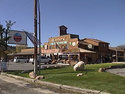
 General store in Tropic (©2001 SW Clyde, courtesy of byways.org) General store in Tropic (©2001 SW Clyde, courtesy of byways.org) | |
 Location in Garfield County and state of Utah Location in Garfield County and state of Utah | |
| Coordinates: 37°37′25″N 112°5′19″W / 37.62361°N 112.08861°W / 37.62361; -112.08861 | |
| Country | United States |
| State | Utah |
| County | Garfield |
| Government | |
| • Mayor | Travis LeFevre |
| • Town Clerk | Dani Harding |
| Area | |
| • Total | 7.94 sq mi (20.55 km) |
| • Land | 7.91 sq mi (20.50 km) |
| • Water | 0.02 sq mi (0.06 km) |
| Elevation | 6,309 ft (1,923 m) |
| Population | |
| • Total | 486 |
| • Estimate | 514 |
| • Density | 64.95/sq mi (25.08/km) |
| Time zone | UTC-7 (Mountain (MST)) |
| • Summer (DST) | UTC-6 (MDT) |
| ZIP code | 84776 |
| Area code | 435 |
| FIPS code | 49-77560 |
| GNIS feature ID | 1446722 |
| Website | www |
Tropic is a town in Garfield County, Utah, United States, along Utah Scenic Byway 12. As of the 2020 census, the town had a population of 486. Tropic was founded in 1891.
Geography
Tropic is in southern Garfield County along Utah Route 12, 7.5 miles (12.1 km) southeast of Bryce Canyon City and 5 miles (8 km) north of Cannonville. It is in the Tropic Valley, drained by the Paria River, a tributary of the Colorado River.
According to the United States Census Bureau, the town has a total area of 8.4 square miles (21.7 km), of which 0.02 square miles (0.06 km), or 0.26%, are water.

Demographics
| Census | Pop. | Note | %± |
|---|---|---|---|
| 1900 | 379 | — | |
| 1910 | 358 | −5.5% | |
| 1920 | 474 | 32.4% | |
| 1930 | 447 | −5.7% | |
| 1940 | 514 | 15.0% | |
| 1950 | 483 | −6.0% | |
| 1960 | 382 | −20.9% | |
| 1970 | 329 | −13.9% | |
| 1980 | 338 | 2.7% | |
| 1990 | 374 | 10.7% | |
| 2000 | 508 | 35.8% | |
| 2010 | 530 | 4.3% | |
| 2019 (est.) | 514 | −3.0% | |
| U.S. Decennial Census | |||
As of the census of 2000, there were 508 people in the town, organized into 160 households and 132 families. The population density was 60.6 people per square mile (23.4/km). There were 206 housing units at an average density of 24.6 per square mile (9.5/km). The racial makeup of the town was 96.06% White, 0.39% Native American, 1.38% from other races, and 2.17% from two or more races. There were no African Americans, Asians, or Pacific Islanders. 2.36% of the population were Hispanic or Latino of any race.
There were 160 households, out of which 41.9% had children under 18 living with them, 73.8% were married couples living together, 5.6% had a female householder with no husband present, and 16.9% were non-families. 13.8% of all households were made up of individuals, and 8.1% had someone who was 65 years of age or older living alone. The average household size was 3.18, and the average family size was 3.52.
The town's population was spread out, with 34.6% under 18, 7.5% from 18 to 24, 22.0% from 25 to 44, 21.7% from 45 to 64, and 14.2% who were 65 years of age or older. The median age was 32 years. For every 100 females, there were 100 males. For every 100 females aged 18 and over, there were 91.9 males.
The median income for a household in the town was $42,500, and the median income for a family was $44,125. Males had a median income of $32,500 versus $22,222 for females. The per capita income for the town was $13,896. 2.1% of the population and 3.0% of families were below the poverty line. Out of the total population, 1.0% of those under 18 and 10.0% of those 65 and older lived below the poverty line.
Notable people
- Wanda Day, drummer of the rock band 4 Non Blondes. Day died on July 10, 1997, at age 36 and is buried in the Tropic cemetery.
See also
References
- "2019 U.S. Gazetteer Files". United States Census Bureau. Retrieved August 7, 2020.
- ^ U.S. Geological Survey Geographic Names Information System: Tropic, Utah
- ^ "Population and Housing Unit Estimates". United States Census Bureau. May 24, 2020. Retrieved May 27, 2020.
- ^ "U.S. Census website". United States Census Bureau. Retrieved January 31, 2008.
- "Explore Census Data". data.census.gov. Retrieved April 11, 2024.
- "Geographic Identifiers: 2010 Demographic Profile Data (G001): Tropic town, Utah". U.S. Census Bureau, American Factfinder. Retrieved March 28, 2017.
- "Census of Population and Housing". Census.gov. Retrieved June 4, 2015.
- "Death: Wanda Marie Day". www.deseret.com. July 13, 1997. Archived from the original on January 25, 2020. Retrieved November 7, 2020.
- Chun, Kimberly. "Noise: Miss understood". The San Francisco Bay Guardian. The San Francisco Bay Guardian. Archived from the original on October 28, 2012. Retrieved November 13, 2008.
- "Life and Times of Wanda Day". Archived from the original on December 16, 2008. Retrieved November 7, 2020.
External links
| Places adjacent to Tropic, Utah | ||||||||||||||||
|---|---|---|---|---|---|---|---|---|---|---|---|---|---|---|---|---|
| ||||||||||||||||
| Municipalities and communities of Garfield County, Utah, United States | ||
|---|---|---|
| County seat: Panguitch | ||
| Cities |  | |
| Towns | ||
| Unincorporated communities | ||
| Ghost towns | ||