| Tsona Cave | |
|---|---|
  | |
| Location | Georgia |
| Coordinates | 42°29′41″N 43°40′46″E / 42.49472°N 43.67944°E / 42.49472; 43.67944 |
| Length | 100 m (330 ft) |
| Discovery | 1958 |
| Geology | Jurassic sandstone formations |
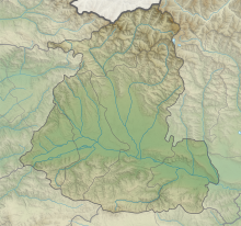
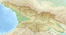
Tsona Cave (Georgian: წონის მღვიმე) is an archaeological site at the head of the river Qvirila in proximity of village Tson [ka] (Georgian: წონა, Ossetian: Цъон) in the Java Municipality in Shida Kartli in Georgia. The site is close to the Bouba-Kakheri pass at south of the Caucasus range.
History
Tsona Cave was discovered by A. Kalandadze in 1958. It was excavated by Kalandadze, Tushabramishvili and later by Z. Kikodze.
The cave is located at 2100 m above sea level and therefore it is one of the highest archaeological cave sites in the country. Excavations at the site revealed Lower and Middle Paleolithic archaeological remains.
References
- Tsona, Georgia 42°28′06″N 43°42′55″E / 42.46833°N 43.71528°E / 42.46833; 43.71528
- Peakfinder 42°27′34″N 43°39′06″E / 42.45944°N 43.65167°E / 42.45944; 43.65167
- Mgeladze, A., Moncel, M.-H., The Acheulean in the South Caucasus (Georgia): Koudaro I and Tsona lithic assemblages, Quaternary International (2015), http://dx.doi.org/10.1016/j.quaint.2015.03.041
- Tushabramishvili, D.M., 1978. Arkheologicheskie panyatniki Tsutskhvatskogo mnogoetajnogo peshernogo kompleska. Metsniereba, Tbilisi.
- Kalandadze, A. N., and Tushabramishvili, D. M. (1978). Tsonskaya peshera (Tconskaya cave).In Arkheologiya i paleogeografiya rannego paleolita Krima i Kavkaza, Moscow, pp. 96– 100.
- Mgeladze, A. (2008). Premières phases de peuplement dans le Caucase: étude des assemblages lithiques des sites géorgiens de Dmanissi (Pleistocène inférieur), de Koudaro I et de Tsona (Pleistocène moyen) (Doctoral dissertation, Paris, Muséum national d'histoire naturelle).
This Georgia location article is a stub. You can help Misplaced Pages by expanding it. |