Census-designated place in Ohio, United States
| Tuppers Plains, Ohio | |
|---|---|
| Census-designated place | |
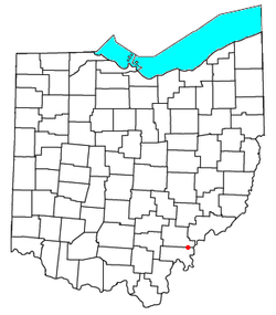
 Location of Tuppers Plains, Ohio Location of Tuppers Plains, Ohio | |
| Coordinates: 39°10′21″N 81°50′48″W / 39.17250°N 81.84667°W / 39.17250; -81.84667 | |
| Country | United States |
| State | Ohio |
| County | Meigs |
| Elevation | 771 ft (235 m) |
| Population | |
| • Total | 438 |
| Time zone | UTC-5 (Eastern (EST)) |
| • Summer (DST) | UTC-4 (EDT) |
| GNIS feature ID | 2628980 |
Tuppers Plains is a census-designated place on the boundary of the Olive and Orange townships of Meigs County, Ohio, United States.
Education
Public education in the community of Tuppers Plains is provided by the Eastern Local School District. Campuses serving the community include the Eastern Elementary School (Grades K-8) and Eastern High School of Reedsville (Grades 9-12).
References
- ^ U.S. Geological Survey Geographic Names Information System: Tuppers Plains, Ohio
- "Tuppers Plains CPD, Ohio - Census Bureau Profile". United States Census Bureau. Retrieved July 25, 2023.
| Municipalities and communities of Meigs County, Ohio, United States | ||
|---|---|---|
| County seat: Pomeroy | ||
| Villages |  | |
| Townships | ||
| CDP | ||
| Unincorporated communities | ||
| Ghost town | ||
This Meigs County, Ohio state location article is a stub. You can help Misplaced Pages by expanding it. |