| Tuxpan River | |
|---|---|
 | |
| Location | |
| Country | Mexico |
| States | Jalisco, Colima, and Michoacán |
| Physical characteristics | |
| Mouth | |
| • coordinates | 19°15′48″N 103°30′25″W / 19.263373°N 103.506889°W / 19.263373; -103.506889 |
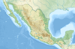
The Tuxpan River, also known as the Coahuayana River is a river of Mexico. It originates in the Trans-Mexican Volcanic Belt south of Lake Chapala. It flows southwards through Tuxpan Municipality, Jalisco, and then forms the eastern border of Colima with Michoacán before emptying into the Pacific Ocean.
See also
References
- "Tuxpan". GeoNames. Retrieved July 27, 2021.
- Atlas of Mexico, 1975 (http://www.lib.utexas.edu/maps/atlas_mexico/river_basins.jpg).
- The Prentice Hall American World Atlas, 1984.
- Rand McNally, The New International Atlas, 1993.
This article related to a river in Mexico is a stub. You can help Misplaced Pages by expanding it. |