| Twin Lakes | |
|---|---|
 | |
  | |
| Location | Mono County, California, United States |
| Coordinates | 38°09′45″N 119°20′11″W / 38.16250°N 119.33639°W / 38.16250; -119.33639 |
| Primary inflows | Cattle Creek, Robinson Creek, Tamarack Creek |
| Primary outflows | Robinson Creek |
| Surface elevation | 7,087 ft (2,160 m) |
| Settlements | Bridgeport, California |
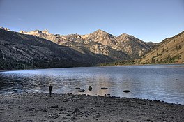
Twin Lakes is a pair of lakes approximately 9 miles (14 km) southwest of the town of Bridgeport in Mono County, California. Mono Village and Twin Lakes resorts lie along the lakeside. The communities around the lake are part of the Twin Lakes census-designated place.
The lakes serve as the northern terminus of the Sierra High Route.
See also
References
- ^ "Twin Lakes". Geographic Names Information System. United States Geological Survey, United States Department of the Interior.
- Roper, Steve (1997). The Sierra High Route: Traversing Timberline Country. Mountaineers Books. p. 14.

This Mono County, California-related article is a stub. You can help Misplaced Pages by expanding it. |