You can help expand this article with text translated from the corresponding article in German. (October 2011) Click for important translation instructions.
|
| Urff | |
|---|---|
 | |
| Location | |
| Country | Germany |
| State | Hesse |
| Physical characteristics | |
| Mouth | |
| • location | Schwalm |
| • coordinates | 51°02′13″N 9°12′19″E / 51.0370°N 9.2053°E / 51.0370; 9.2053 |
| Length | 20.2 km (12.6 mi) |
| Basin features | |
| Progression | Schwalm→ Eder→ Fulda→ Weser→ North Sea |
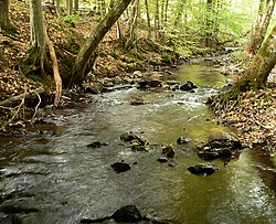
Urff is a 20.1-kilometre-long (12.5 mi) tributary of the river Schwalm in Waldeck-Frankenberg and Schwalm-Eder-Kreis, North Hesse (Germany). It flows into the Schwalm near Niederurff.
History
The Urff starts in the Kellerwald. Its source lies west-southwest of the Bad Wildungen district of Hundsdorf and east-northeast of the Haina district of Löllbach on the transition area between Große Aschkoppe (639.8 m) in the southeast, Alter Koppe (591.4 m) in the southwest, and Wölftekopf (567.1 m) in the north-northeast.
The Urff runs through the wooded Kellerwald-Edersee Nature Park in an eastward direction and through Hundsdorf, where it bends to the south-east towards Armsfeld. Below Armsfeld, south of Auenberg (610.7 m), the creek turns east and flows past the villages of Fischbach and Bergfreiheit, the ruins of Löwenstein Castle (341.2 m), and Oberurff-Schiffelborn after Niederurff.
The confluence of the Urff in the Schwalm is in the Löwensteiner Grund south-east of Niederurff at a height of about 193.5 m; to the northeast rises the Altenburg (432.7 m).
Catchment Area and Tributaries
The Urff is an Order III body of water. Its drainage basin covers 41.74 km.
The tributaries of the Urff include, among others (viewed downstream):
- Heerbach (on the right; confluence between Hundsdorf and Armsfeld)
- Appenbach (on the right; confluence between Armsfeld and Berg Freiheit)
- Kohlbach (on the left; confluence between Armsfeld and Berg Freiheit)
Localities
The villages on the Urff are (viewed downstream):
- Bad Wildungen - Hundsdorf
- Bad Wildungen - Armsfeld
- Bad Wildungen - Bergfreiheit
- Bad Zwesten - Oberurff-Schiffelborn
- Bad Zwesten - Niederurff
See also
References
- ^ Water map service of the Hessian Ministry for the Environment, Energy, Agriculture and Consumer Protection (Hessisches Ministerium für Umwelt, Energie, Landwirtschaft und Verbraucherschutz)
This article related to a river in Hesse is a stub. You can help Misplaced Pages by expanding it. |