| Varnek Ва́рнек | |
|---|---|
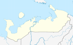
| Location of Varnek | |
  | |
| Coordinates: 69°42′55″N 60°3′36″E / 69.71528°N 60.06000°E / 69.71528; 60.06000 | |
| Country | Russia |
| Federal subject | Nenets Autonomous Okrug |
| Founded | first half of the 1930s |
| Population | |
| • Total | 101 |
| Time zone | UTC+3 (MSK |
| Postal code(s) | 166000 |
| Dialing code(s) | +7 81857 |
| OKTMO ID | 11811479106 |
Varnek is a village on Vaygach Island of Zapolyarny District, Nenets Autonomous Okrug, Russia. It had a population of 101 as of 2010, an increase from its population of 94 in 2002.
Geography
Varnek is located on the southern coast of Vaygach Island.
History
In 1921, zinc-lead ores were found in the area, so a mine was established where prisoners of the Gulag worked. The settlement was established in the first half of the 1930s, named after Alexander Ivanovich Varnek, a Russian explorer of the Arctic. Varnek was the last village in Nenets Autonomous Okrug to be able to get phone calls, being introduced in 2011.
Climate
Varnek has a subarctic climate (Dfc).
References
- Russian Federal State Statistics Service (2011). Всероссийская перепись населения 2010 года. Том 1 [2010 All-Russian Population Census, vol. 1]. Всероссийская перепись населения 2010 года (in Russian). Federal State Statistics Service.
- "Об исчислении времени". Официальный интернет-портал правовой информации (in Russian). 3 June 2011. Retrieved 19 January 2019.
- Почта России. Информационно-вычислительный центр ОАСУ РПО. (Russian Post). Поиск объектов почтовой связи (Postal Objects Search) (in Russian)
- "Варнек. Ржавые бочки, боевые лебеди и пулемет Эйхманса". 19 August 2019.
- "Арктика, полюс, северный, южный, вездеход, антарктида, путешествие экспедиционный центр". www.ec-arctic.ru. Archived from the original on 10 June 2015. Retrieved 22 May 2022.