| This article relies largely or entirely on a single source. Relevant discussion may be found on the talk page. Please help improve this article by introducing citations to additional sources. Find sources: "Vorderer Brochkogel" – news · newspapers · books · scholar · JSTOR (November 2024) |
| Vorderer Brochkogel | |
|---|---|
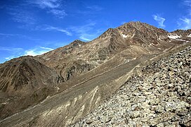
 Vorderer Brochkogel. Vorderer Brochkogel. | |
| Highest point | |
| Elevation | 3,565 m (11,696 ft) |
| Prominence | 169 m (554 ft) |
| Parent peak | Hinterer Brochkogel (Wildspitze) |
| Coordinates | 46°52′29″N 10°51′03″E / 46.87472°N 10.85083°E / 46.87472; 10.85083 |
| Geography | |
 | |
| Parent range | Ötztal Alps |
| Climbing | |
| First ascent | 1851 during a geological survey |
| Easiest route | South ridge from the Breslauer Hütte or Vernagthütte |
The Vorderer Brochkogel (German pronunciation: [ˈfɔʁdəʀɐ ˈbʀɔχˌkoːɡl̩] ) is a mountain in the Weisskamm group of the Ötztal Alps.
References
- Klier, Walter (2006). Ötztaler Alpen. Bergverlag Rother. ISBN 978-3-7633-1123-1.
This Tyrol location article is a stub. You can help Misplaced Pages by expanding it. |