| Waikabubak | |
|---|---|
 Waikabubak Waikabubak | |
  | |
| Coordinates: 9°38′09″S 119°24′47″E / 9.63583°S 119.41306°E / -9.63583; 119.41306 | |
| Country | Indonesia |
| Region | Lesser Sunda Islands |
| Province | East Nusa Tenggara |
| Regency | West Sumba |
| Area | |
| • Total | 44.71 km (17.26 sq mi) |
| Population | |
| • Total | 33,821 |
| Time zone | UTC+8 (WITA / UTC) |
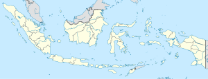
Waikabubak is a town in East Nusa Tenggara province of Indonesia and it is the capital of West Sumba Regency. Waikabubak is the second largest town on Sumba island after Waingapu; it had a population of 33,064 at the 2020 Census, and the official estimate as at mid 2022 was 33,821.
Gallery
-
 The traditional village of Tarung near Waikabubak (picture taken in 2008)
-
 1910 picture of a Marapu holy place in Tarung
-
 1910 picture of a richly decorated grave in Waikabubak
References
- Badan Pusat Statistik, Jakarta, 2023.
- Badan Pusat Statistik, Jakarta, 2021.
- Badan Pusat Statistik, Jakarta, 2023.
This East Nusa Tenggara location article is a stub. You can help Misplaced Pages by expanding it. |