| Warrenton–Fauquier Airport | |||||||||||
|---|---|---|---|---|---|---|---|---|---|---|---|
 | |||||||||||
| Summary | |||||||||||
| Airport type | Public | ||||||||||
| Owner | Fauquier County | ||||||||||
| Serves | Warrenton, Virginia | ||||||||||
| Elevation AMSL | 336 ft / 102 m | ||||||||||
| Coordinates | 38°35′11″N 077°42′38″W / 38.58639°N 77.71056°W / 38.58639; -77.71056 | ||||||||||
| Map | |||||||||||
   | |||||||||||
| Runways | |||||||||||
| |||||||||||
| Statistics (2007) | |||||||||||
| |||||||||||
| Source: Federal Aviation Administration | |||||||||||
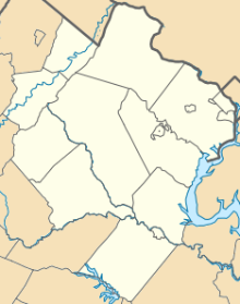
Warrenton–Fauquier Airport (ICAO: KHWY, FAA LID: HWY, formerly W66) is a public airport 14 miles southeast of Warrenton, a town in Fauquier County, Virginia.
Most U.S. airports use the same three-letter location identifier for the FAA and IATA, but this airport is HWY to the FAA and has no IATA code.

Facilities
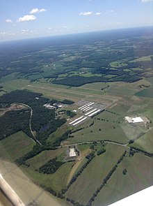
Warrenton–Fauquier Airport covers 407 acres (165 ha) at an elevation of 336 feet (102 m). Its single runway, 15/33, is 5,000 by 100 feet (1,524 m × 30 m) asphalt.
In the year ending June 29, 2007 the airport had 42,184 aircraft operations, average 115 per day: 98% general aviation, 1% air taxi and <1% military. 119 aircraft were then based at this airport: 84% single-engine (100), 13% multi-engine, 3% ultralight and 1% helicopter.
Accidents and incidents
On December 3, 2023, a 62-year-old pilot was killed while piloting a Beechcraft C23 aircraft when it collided with several trees while attempting to land at the airport. The aircraft had no other occupants other than the pilot, and no one was injured on the ground.
See also
References
- ^ FAA Airport Form 5010 for HWY PDF, effective 2008-04-10
- Great Circle Mapper: KHWY - Warrenton, Virginia
- Allen, Gabby; Belloso, Paola; Bass, Randi (3 December 2023). "Pilot who died in plane crash in Fauquier County identified". DC News Now. Retrieved 5 December 2023.
- Lyons, Ivy; Newton, Grace (4 December 2023). "62-year-old man identified as pilot killed in Fauquier County plane crash". WTOP News. Retrieved 5 December 2023.
External links
- Resources for this airport:
- FAA airport information for HWY
- AirNav airport information for KHWY
- FlightAware airport information and live flight tracker
- NOAA/NWS weather observations: current, past three days
- SkyVector aeronautical chart, Terminal Procedures
- FAA Terminal Procedures for HWY, effective November 28, 2024