| Wat Sommanat วัดโสมนัส | |
|---|---|
| Khwaeng | |
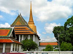
 The eponymous Wat Sommanat Wihan The eponymous Wat Sommanat Wihan | |
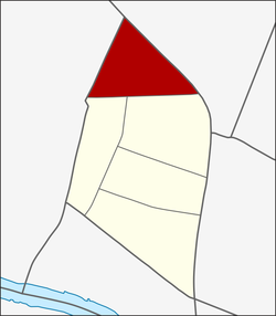
 Location in Pom Prap Sattru Phai District Location in Pom Prap Sattru Phai District | |
| Country | Thailand |
| Province | Bangkok |
| Khet | Pom Prap Sattru Phai |
| Area | |
| • Total | 0.350 km (0.135 sq mi) |
| Population | |
| • Total | 6,672 |
| Time zone | UTC+7 (ICT) |
| Postal code | 10100 |
| TIS 1099 | 100805 |

Wat Sommanat (Thai: วัดโสมนัส, pronounced [wát sǒːm.mā.nát]) is a khwaeng (sub-district) in Pom Prap Sattru Phai District, Bangkok.
Description & topography
Wat Sommanat is named after Wat Sommanat Wihan, a local Buddhist temple that faces Khlong Phadung Krung Kasem canal. The area is considered as the northernmost part of the district, with a total area of 0.350 km (0.135 mi).
The sub-district bordered by other areas (from the north clockwise): Dusit and Suan Chitlada in Dusit District (Khlong Phadung Krung Kasem is a borderline), Si Yaek Maha Nak in Dusit District (Khlong Phadung Krung Kasem is a borderline), Khlong Maha Nak and Ban Bat in its district (Lan Luang Road is a borderline), and Ban Phan Thom with Bang khun Phrom in Phra Nakhon District (Outer Ratchadamnoen Avenue is a borderline).
It can also be divided into five communities.
Nang Loeng is another name for the area.
Population
In 2019, it had a total population of 6,672 people.
Places
- Pom Prap Sattru Phai Office District
- Wat Sommanat Wihan
- Wat Sunthorn Thammathan (Wat Khae Nang Loeng)
- Talat Nang Loeng
- Thewakam Rangrak Bridge (shared with Si Yaek Maha Nak and Suan Chitlada of Dusit)
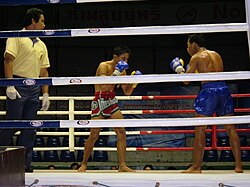
- Rajadamnern Boxing Stadium
- Ministry of Tourism and Sports
- Nanglerng Police Station
- King Prajadhipok Museum
Cites
- Administrative Strategy Division, Strategy and Evaluation Department, Bangkok Metropolitan Administration (2021). สถิติกรุงเทพมหานครประจำปี 2563 [Bangkok Statistics 2020] (PDF) (in Thai). Retrieved 27 November 2021.
{{cite web}}: CS1 maint: multiple names: authors list (link) - "สำนักงานเขตป้อมปราบศัตรูพ่าย" [Pom Prap Sattru Phai District]. Bangkok.go.th (in Thai).
- กรมการปกครอง. กระทรวงมหาดไทย. "รายงานสถิติจำนวนประชากรและบ้าน ประจำปี พ.ศ. 2562." . เข้าถึงได้จาก: http://stat.dopa.go.th/stat/statnew/statTDD/views/showZoneData.php?rcode=1008&statType=1&year=62 2563. สืบค้น 29 พฤษภาคม 2563. Thai: ภาษาไทย
13°45′30″N 100°30′47″E / 13.758427°N 100.513061°E / 13.758427; 100.513061
Categories: