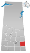
Special service area in Saskatchewan, Canada
| Welwyn | |
|---|---|
| Special service area | |
  | |
| Coordinates: 50°19′30″N 101°31′10″W / 50.324984°N 101.519314°W / 50.324984; -101.519314 | |
| Country | Canada |
| Province | Saskatchewan |
| Census division | 5 |
| Rural municipality | Moosomin No. 121 |
| Incorporated (village) | June 11, 1907 |
| Dissolved (special service area) | May 1, 2018 |
| Area | |
| • Land | 0.64 km (0.25 sq mi) |
| Population | |
| • Total | 133 |
| • Density | 208.1/km (539/sq mi) |
| Time zone | UTC-6 (CST) |
| Area code | 306 |
| Highways | |
Welwyn is a special service area in the Rural Municipality of Moosomin No. 121, Saskatchewan, Canada that held village status prior to May 2018. It is located in the southeastern portion of Saskatchewan, near the Manitoba border. The community was named for Welwyn, in Hertfordshire, England at the suggestion of James Wake, who homesteaded just across the Manitoba border. In 2016, the population was 133.
History
Welwyn incorporated as a village on June 11, 1907. It restructured on May 1, 2018, relinquishing its village status in favour of becoming a special service area under the jurisdiction of the Rural Municipality of Moosomin No. 121.
Demographics
In the 2016 Census of Population conducted by Statistics Canada, Welwyn recorded a population of 133 living in 61 of its 61 total private dwellings, a -1.5% change from its 2011 population of 135. With a land area of 0.64 km (0.25 sq mi), it had a population density of 207.8/km (538.2/sq mi) in 2016.
Welwyn Centennial Regional Park
Welwyn Centennial Regional Park (50°20′27″N 101°31′11″W / 50.3408°N 101.5197°W / 50.3408; -101.5197) is a regional park about 1.6 kilometres (0.99 mi) north of Welwyn in the neighbouring RM of Rocanville No. 151. It is on the south side of the mile-long reservoir on Beaver Creek. The park was built by volunteers in 1967 to commemorate the Canadian Centennial. Activities at the park include camping, swimming, picnicking, boating, and hiking through a forest of native oak trees.
See also
References
- ^ "Urban Municipality Incorporations" (PDF). Saskatchewan Ministry of Government Relations. p. 14. Archived from the original on October 15, 2014. Retrieved October 13, 2019.
- ^ "Restructuring of the Village of Welwyn" (PDF). The Saskatchewan Gazette. April 20, 2018. pp. 844–849. Retrieved October 13, 2019.
- ^ "Population and dwelling counts, for Canada, provinces and territories, and census subdivisions (municipalities), 2016 and 2011 censuses – 100% data (Saskatchewan)". Statistics Canada. February 20, 2019. Retrieved October 13, 2019.
- Barry, Bill (September 2005). Geographic Names of Saskatchewan. Regina, Saskatchewan: People Places Publishing, Ltd. p. 449. ISBN 1-897010-19-2.
- "Welwyn Centennial Regional Park". Canadian Geographical Names Database. Government of Canada. Retrieved September 25, 2023.
- "Beaver Creek". Canadian Geographical Names Database. Government of Canada. Retrieved September 25, 2023.
- "Welwyn Centennial Regional Park". Tourism Saskatchewan. Government of Saskatchewan. Retrieved September 26, 2023.
- "Regional Parks of Saskatchewan". Saskatchewan Regional Parks. Retrieved September 26, 2023.
