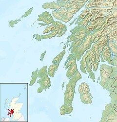
Human settlement in Scotland
| Whistlefield | |
|---|---|
 | |
| OS grid reference | NS 14426 93276 |
| • Edinburgh | 70 mi (110 km) |
| Council area |
|
| Lieutenancy area |
|
| Country | Scotland |
| Sovereign state | United Kingdom |
| Post town | DUNOON |
| Postcode district | PA23 |
| Dialling code | 01369 |
| UK Parliament |
|
| Scottish Parliament |
|
| 56°05′46″N 4°59′05″W / 56.096205°N 4.984861°W / 56.096205; -4.984861 | |
Whistlefield is a hamlet on the east shore of Loch Eck on the Cowal Peninsula, in Argyll and Bute, West of Scotland. It is home to the Category C listed building, the Whistlefield Inn, which was established around 1801–1804. The hamlet is within the Argyll Forest Park, which is itself part of the Loch Lomond and The Trossachs National Park.
References
- Ordnance Gazetteer of Scotland A Graphic and Accurate Description of Every Place in Scotland (1901) - p. 1611
- "The Whistlefield Inn, Dunoon | Homepage". www.thewhistlefieldinn.com. Retrieved 2 March 2020.
- "WHISTLEFIELD INN INCLUDING ANCILLARY BUILDINGS AND BOUNDARY WALLS (LB5060)". portal.historicenvironment.scot. Retrieved 2 March 2020.
- "Argyll Forest Park - Forestry Commission Scotland". Scotland.forestry.gov.uk. Retrieved 17 January 2017.
- "Map of Loch Lomond and the Trossachs National Park" (PDF). Loch Lomond & The Trossachs National Park Authority. Retrieved 30 July 2020.
External links
- Map sources for Whistlefield, Argyll
This Argyll and Bute location article is a stub. You can help Misplaced Pages by expanding it. |