| Willow Lake | |
|---|---|
 | |
  | |
| Location | Saguache County, Colorado |
| Coordinates | 37°59′39″N 105°36′31″W / 37.99409°N 105.60856°W / 37.99409; -105.60856 |
| Type | Glacial |
| Primary inflows | Willow Creek |
| Primary outflows | Willow Creek |
| Basin countries | United States |
| Max. length | 0.26 mi (0.42 km) |
| Max. width | 0.12 mi (0.19 km) |
| Surface elevation | 11,580 ft (3,530 m) |
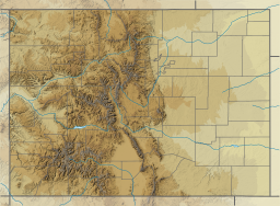
Willow Lake, also known as the lower Willow Creek Lake, is an alpine lake in Saguache County, Colorado, United States, located in the Sangre de Cristo Range within the Sangre de Cristo Wilderness in Rio Grande National Forest. The lake is accessed from the Willow Lake Trail (trail 865) at the South Crestone Lake Trailhead east of Crestone, Colorado. Willow Lake is directly north of Challenger Point and south of Mount Adams. Willow Creek is both the inflow and outflow to the lake, and there are waterfalls at both lake's inflow and outflow.
Gallery
References
- "Willow Creek Lakes". Geographic Names Information System. United States Geological Survey, United States Department of the Interior. Retrieved September 7, 2013.
- Sangre de Cristo Mountains (Map). 1:75000. Trails Illustrated. National Geographic. 2004.
This Colorado state location article is a stub. You can help Misplaced Pages by expanding it. |

