| Windy Arbour Na Glasáin | |||||
|---|---|---|---|---|---|
 The northbound platform at Windy Arbour The northbound platform at Windy Arbour | |||||
| General information | |||||
| Location | Churchtown Road Lower/St. Columbanus' Road Windy Arbour, County Dublin Ireland | ||||
| Coordinates | 53°18′06″N 6°15′03″W / 53.30158879339281°N 6.250709227476935°W / 53.30158879339281; -6.250709227476935 | ||||
| Owned by | Transport Infrastructure Ireland | ||||
| Operated by | Transdev (as Luas) | ||||
| Line(s) | Green | ||||
| Platforms | 2 | ||||
| Construction | |||||
| Structure type | At-grade | ||||
| Other information | |||||
| Fare zone | Green 2 | ||||
| Key dates | |||||
| 30 June 2004 | Stop opened | ||||
| 2018 | Platforms extended | ||||
| |||||
Windy Arbour (Irish: Na Glasáin) is a stop on the Luas light-rail tram system in Dún Laoghaire–Rathdown, south of Dublin, Ireland. It opened in 2004 as a stop on the Green Line from St Stephen's Green to Sandyford. It serves the suburbs of Windy Arbour, Churchtown, and Clonskeagh.
Location and access
| Legend | |||||||||||||||||||||||||||||||||||||||||||||||||||||||||||||||||||||||||||||||||||||||||||||||||||||||||||||||||||||||||||||||||||||||||||||||||||||||||||||||||||||||||||||||||||||||||||||||||||||||||||||||||||||||||||||||||||||||||||||||||||||||||||||||||||||||||||||||||||||||||||||||||||||||||||||||||||||||||||||||||||||||||||||||||||||||||||||||||||||||||||||||||||||||||||||||
| |||||||||||||||||||||||||||||||||||||||||||||||||||||||||||||||||||||||||||||||||||||||||||||||||||||||||||||||||||||||||||||||||||||||||||||||||||||||||||||||||||||||||||||||||||||||||||||||||||||||||||||||||||||||||||||||||||||||||||||||||||||||||||||||||||||||||||||||||||||||||||||||||||||||||||||||||||||||||||||||||||||||||||||||||||||||||||||||||||||||||||||||||||||||||||||||
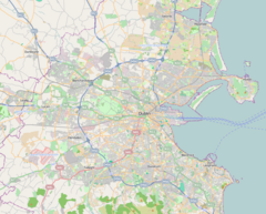
The Green Line runs on mostly segregated track, making use of the disused railway alignment of the disused railway alignment from Bray to Harcourt Street. The Windy Arbour stop is located between Churchtown Road Lower and St. Columbanus' Road on the site of a former footbridge that crossed over the railway. The stop has the signs, displays, shelters, and ticket machines common to all Luas stops. It has entrances from each of the neighbouring roads. The Churchtown Road entrance consists of a layby which can be used by cars and buses to drop off Luas passengers. The St. Columbanus' Road entrance is a paved plaza leading from a bend in the road to the northern end of the platforms.
The stop is also served by Dublin Bus routes 44, and 44D.
Services
Trams stop at the stop coming from either end every 2-10 minutes.
| Preceding station | Following station | |||
|---|---|---|---|---|
| Milltowntowards Parnell or Broombridge | Green Line | Dundrumtowards Sandyford or Brides Glen | ||
References
- O'Callaghan, Gavin (4 June 2019). "Gardai investigating Luas stop incident as shocking racist video goes viral". DublinLive.
- "Luas Is Launched". RTÉ Archives.
- "Immaculately renovated 1930s home beside the Dodder in Churchtown for €1.25m". The Irish Times.
- Hegarty, Peter; Rose, Howard (28 October 2005). Dublin. Premier Guides Ltd. ISBN 9781904895015 – via Google Books.
- "Windy Arbour". Luas.
This European tramway-related article is a stub. You can help Misplaced Pages by expanding it. |
