| Wiscasset Municipal Airport | |||||||||||
|---|---|---|---|---|---|---|---|---|---|---|---|
| Summary | |||||||||||
| Airport type | Public | ||||||||||
| Operator | Town of Wiscasset | ||||||||||
| Location | Wiscasset, Maine | ||||||||||
| Opened | 1961 | ||||||||||
| Elevation AMSL | 70 ft / 21 m | ||||||||||
| Coordinates | 43°57′41″N 069°42′45″W / 43.96139°N 69.71250°W / 43.96139; -69.71250 | ||||||||||
| Website | www | ||||||||||
| Map | |||||||||||
  | |||||||||||
| Runways | |||||||||||
| |||||||||||
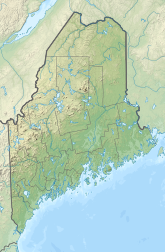
Wiscasset Municipal Airport (IATA: ISS, ICAO: KIWI, FAA LID: IWI) is a public-use airport located three miles (5 km) southwest of the central business district of Wiscasset, a town in Lincoln County, Maine, United States. This general aviation airport is publicly owned by Town of Wiscasset. As of 2007 it is not served by commercial aircraft, though scheduled air service was once available on Downeast Airlines.
Although most U.S. airports use the same three-letter location identifier for the FAA and IATA, Wiscasset Airport is assigned IWI by the FAA and ISS by the IATA. The airport's ICAO identifier is KIWI.
Facilities
Wiscasset Municipal Airport covers an area of 196 acres (79 ha) and has one runway:
- Runway 7/25: 3,397 x 75 ft (1,035 x 23 m), Asphalt surface
Land was purchased for the airport in 1957. The airport opened in 1961 with a 2,800 foot runway. In 1968 the runway was length was extended.
On April 27, 2020, the FAA announced an award of $3.2 million to repave runway 7/25.
See also
References
- FAA Airport Form 5010 for IWI PDF
- Great Circle Mapper: ISS / KIWI - Wiscasset, Maine
- ^ O'Brien, Kathleen (April 29, 2020). "Wiscasset airport receives over $3 million to repave runway". Portland Press Herald. Retrieved May 4, 2020.
External links
- Resources for this airport:
- FAA airport information for IWI
- AirNav airport information for KIWI
- ASN accident history for ISS
- FlightAware airport information and live flight tracker
- NOAA/NWS weather observations: current, past three days
- SkyVector aeronautical chart, Terminal Procedures
This article about an airport in Maine is a stub. You can help Misplaced Pages by expanding it. |